MAPS — VIRGINIA SHASTEEN LOCATIONS
![]()
MAPS — VIRGINIA
SHASTEEN LOCATIONS
![]()
| Objective is to research parentage of the James "Buff" Shasteen, James J River Shasteen, and James "Pedlar" Shasteen and brother Jesse Shasteen. This involves researching some of the Chastain lineage also and Chastain properties/locations is only incorporated here for that purpose and is not represented to be a research of the Chastain lineage. |
|
Development in Process —Due
to the complexities of the graphics involved, much of this work is in Microsoft Word doc
files on tabloid size pages to yield the best resolution on screen. If printing
to paper, in the print dialog box, select Scale to paper size and select your
size paper. I have attempted to indicate the page size in the file name.
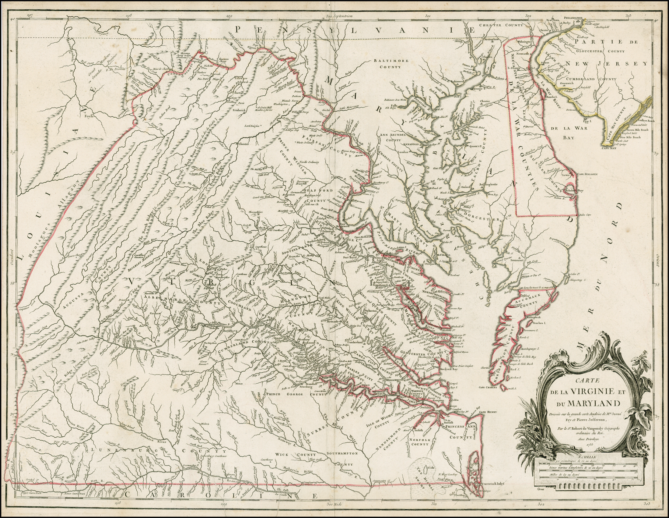
Links in order of pertinence at this point: Maps_VA_Shasteen_Loc.htm - This page, Virginia Shasteen Locations My Google Map - Objective is to locate approximate landmarks pertinent to early Shasteen/Chastain land holdings https://mapsengine.google.com/map/viewer?mid=zZyAhcXlp3mM.k_-tlaMmORzM - May take a bit of time to load. Most landmarks are based on USGS coordinates for present day landmarks. Land transactions are both educated guesses Land grants are based on Deedmapper GPS coordinates, see Maps_Deedmapper Maps_VA_Shasteen_Loc_Amherst_SW_TAB.doc - Objective is to estimate location of early Shasteen land transactions and landmarks on a detail map of southwest Amherst County, VA. Word doc file for technical reasons. Maps_VA_Shasteen_Loc_GEN.doc - Objective is to locate present day approximate locations of Shasteen/Chastain families and holdings on a 1790 key counties in VA Map (below). Word doc file for technical reasons. Maps_VA_Shasteen_Loc_SE_US.doc — Objective is to visually map the early migration of Shasteen/Chastain first and second generation dispersion from VA to determine likely geographic locations of possible interaction. Word doc file for technical reasons. ** Maps_VA_1755 — Best circa 1755 Virginia map with readable detail - Giles Robert de Vaugondy, Carte de la Virginie et du Maryland 1755 Used to locate old locations like Manakin town. ** MANAKIN TOWN - The French Huguenot Settlement in Virginia - National Humanities Center - Report on Manakin Town Superseded old files, retained just for potential reference: — Map_AmherstVA.htm - shows original web page attempt to place geographic locations, etc., — Map_AmherstVA.doc - shows original doc attempt to place geographic locations, etc |
|
Resources used: See
also
Genealogy Lead Page
Maps and Links
sections Virginia County Changes : http://homepages.rootsweb.ancestry.com/~george/countyformations/virginiaformationmaps.html#Text Map Location Resource: USGS Geographic Names Info System (GNIS): http://geonames.usgs.gov/apex/f?p=136:1:0 Bridgehunter Detail Current County Maps: Albemarle, Amherst, Bedford, Buckingham, Fluvanna, Franklin, Goochland, Rockbridge Cost inquiry Feb 2014 regarding deed research made to: http://historytech.com/ |
|
1865 Counties information below
— Albemarle —Amherst
— Augusta —
Bedford —
Buckingham —
Campbell — Charlotte — Franklin — Goochland — Henrico — Rockbridge — Out of State — |
|
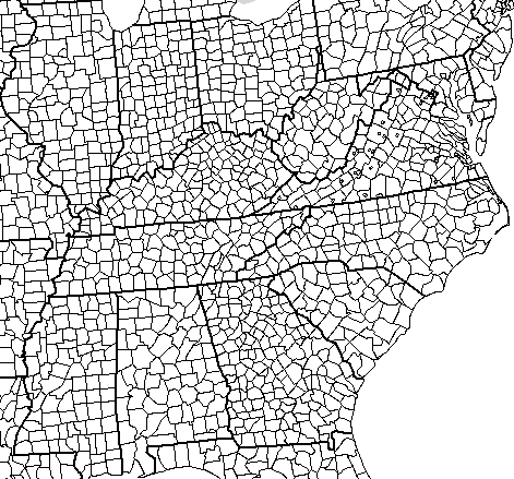
1790
key counties in VA Map -
Later,
Amherst split to form Nelson from the top half circa 1807, and in 1845 part of
Buckingham, Campbell, Prince Edward to form Appomattox
|
|
Current Map with
counties for South East US
|
|
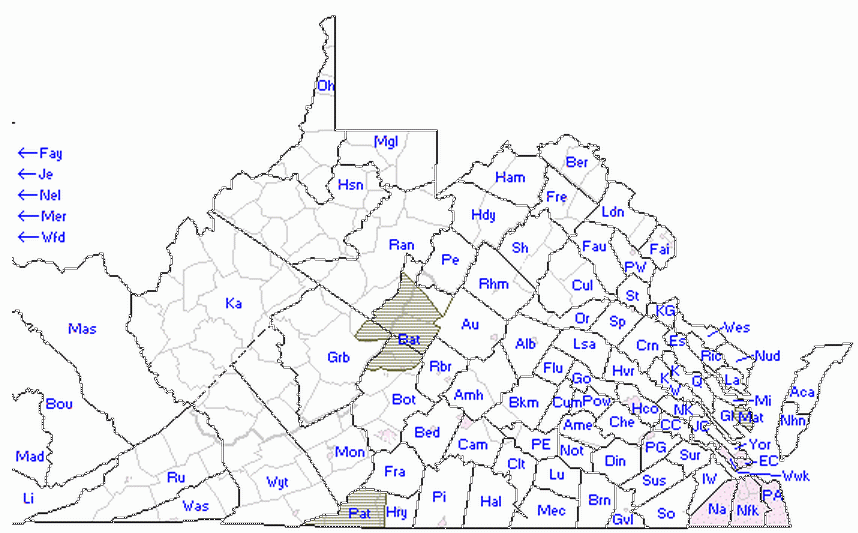
1790 Census
map with Modern Counties Overlaid in Light Gray - To be able to
see relative locations in old deed to current times.
|
|
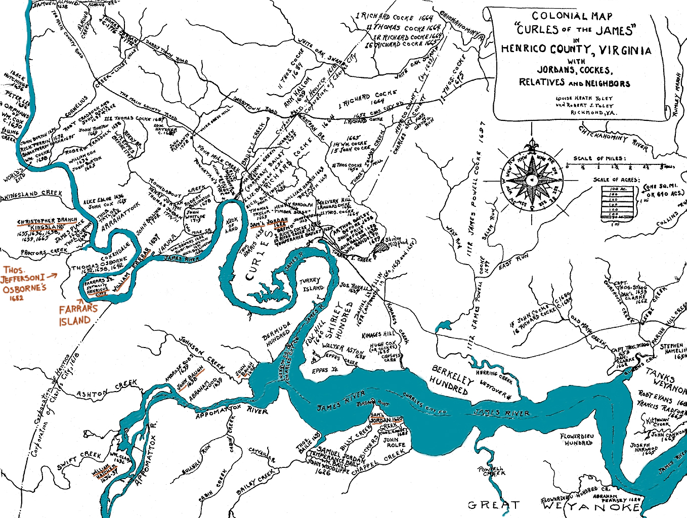
Colonial map
from the book "Early Virginia Families Along the James River" showing earliest
land patents of Virginia settlers on the Curles of the James, who were granted
land for the transportation of persons to the colony. Jamestown, not shown,
would be to the east (right) side. The second settlement, the City of Henricus,
was abandoned after the 1622 Indian Massacre during which one third of the
colonists were killed, and became known as Farrar's Island in 1637 when the
patent was granted posthumously to Ancient Planter William Farrar (1583-1637).
Map is just for interest sake.
|
|
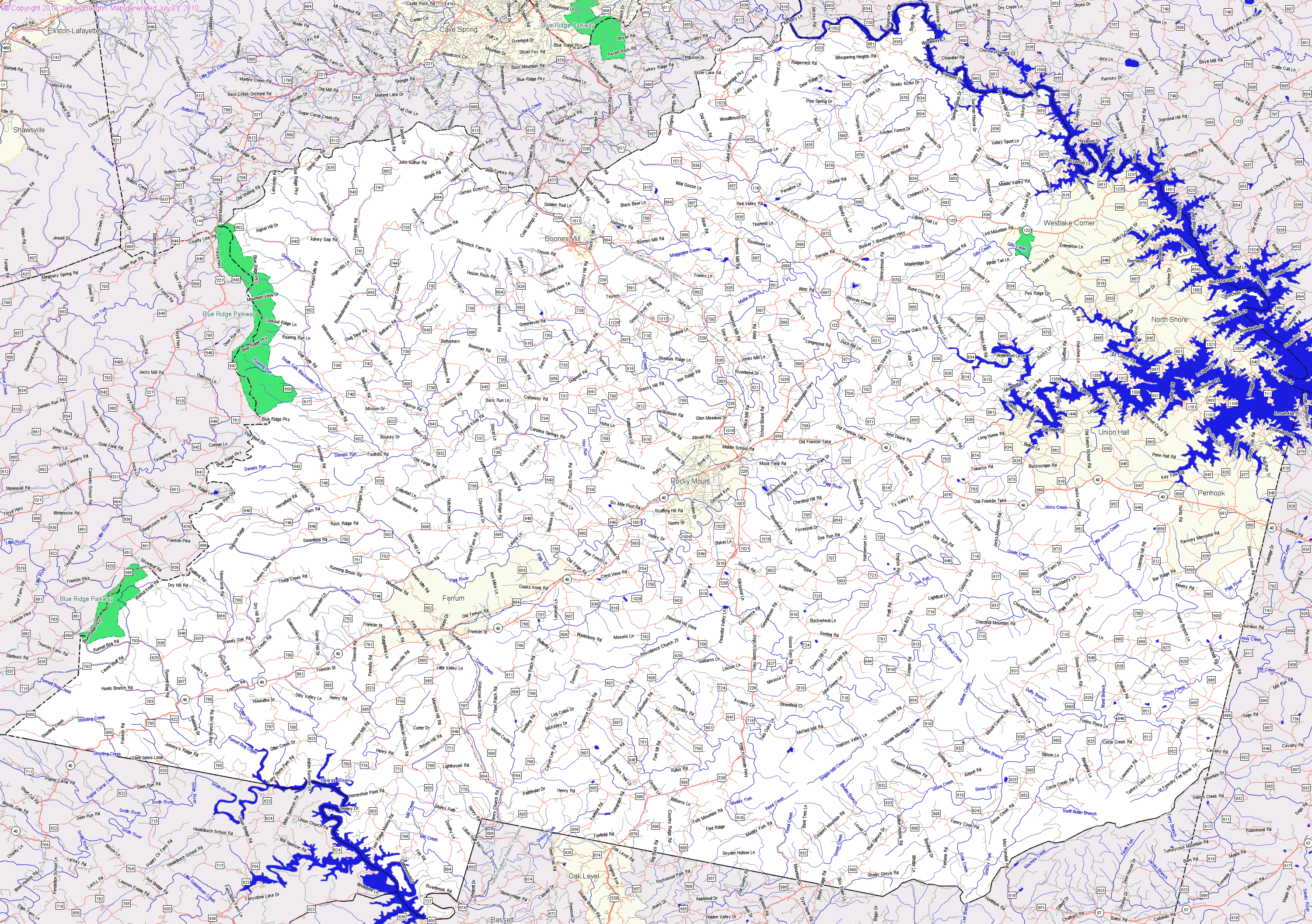
Following are individual maps of each
pertinent county circa 1895 with key land transactions. |
|
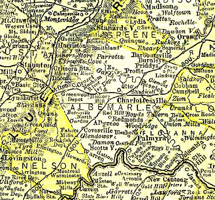
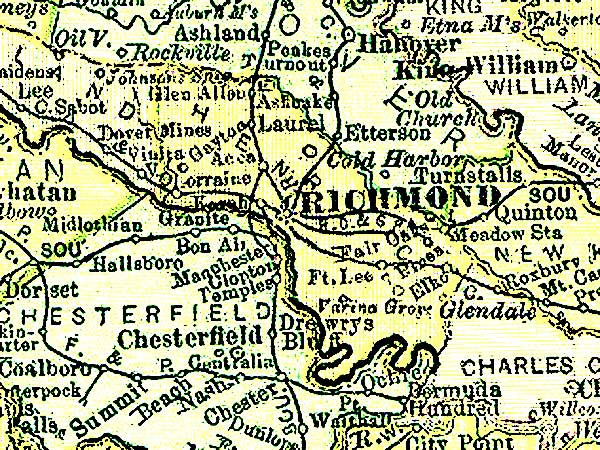
Albemarle County - 1895 - Albemarle
formed from Goochland - 1744 - Source:
http://www.livgenmi.com/1895/
-
Albemarle Co., Courthouse: created in 1744, all order books except the first and all loose papers were destroyed in Tarleton's raid on Charlottesville in 1781. - See more at: http://www.genealogyinc.com/virginia/va-counties/#courthouse. Back to Counties Information above
|
|
Albemarle Items Back to Counties Information above Albemarle - 1 Apr 1749 Land Grant Author Link Shastood, James. grantee. - Title Link Land grant 1 April 1749..- Source LVA Summary Location: Albemarle County. Description: 150 acres on the head branches of Huffs Creek on the side of the Tobacco Row Mountain. [Note: This would appear to be in present day Amherst Co on the north east side of Tobacco Row Mountains] Source: Land Office Patents No. 28, 1746-1749 (v.1 & 2 p.1-730), p. 571 (Reel 26). Part of the index to the recorded copies of patents for land issued by the Secretary of the Colony serving as the colonial Land Office. The collection is housed in the Archives at the Library of Virginia. Other Format Available on microfilm. Virginia State Land Office. Patents 1-42, reels 1-41. |
|
Albemarle Author Link Chastain, Peter. grantee. - Title Link Land grant 16 August 1756..- Source LVA Summary Location: Albemarle County. Description: 396 acres on the branches of Hunts Creek. Source: Land Office Patents No. 34, 1756-1765, p. 116 (Reel 33-34). Part of the index to the recorded copies of patents for land issued by the Secretary of the Colony serving as the colonial Land Office. The collection is housed in the Archives at the Library of Virginia. (Hunt's Creek is a branch of the Slate River. The location of this man's property – first 400 acres and then 396 more – was near the present Buckingham Baptist Church and New Canton, Virginia. See the USGS map for Arvonia/Virginia. Peter received the first grant on December 1, 1740, and the second on August 16, 1756. A Peter Chastain also received a grant of 69 acres on both sides of Bear Creek in Charlotte County, Virginia, on August 1, 1772. I have not seen this last property attributed to the Peter Chastain who was the presumed son of Pierre Chastain, Sr., but Charlotte County is south of Buckingham County – and in the direction of South Carolina.) |
|
Albemarle
- From my Research File 20 Aug 1748 - De-1-129 - Sharstead, James witness Davis spells Shasted, sale of 580 A from John Thrasher to James Smith - Davis pg 14. pg 129 Deed book – “20 Aug 1748 JNO THRASHER planter, to JAS SMITH planter for £100. 400 acres both sides Buffaloe near Blue Mts., pat 1 Feb 1738, also 388 acres adj grantor the river. Davis path, Buffalo River pat 20 Sep 1745, Wit Wm Cabell SR and JR Luke Carnell Jas SHASTED” 1 Apr 1749 - 571-572 - James Shastood 150 Acre land grant - 150 Acre land grant to James Shastood, Land was at the head branches of Huffs Creek and on the side of the Tobacco Row Mountains, bounded by Benjamin Stennet’s property. (Source: Val Burd - Albemarle County Order Book 1744-1748, Page 290 Surveys by Joshua Fry) 24 Jan 1749 - De- 1-217 Benj. Mims to Wm. Cabell 200 A S. side Fluvanna adj grantee; cliff by river. Judith, wife of Benj. Mims. Wit: Susanna Manascho, Eliz. & Jas Sharsted. This is near the James River above Scotsville VA per note from Am Gen Society About 45 miles NE from Amherst VA. (Source: Val Burd - James Shastood 1 April 1749 Albemarle Co VA De-pgs 571, 572, 1749 land grant.doc) (Source: Val Burd: Davis book page 18 Albemarle County Deed Book 1, page 217 24 Jan. 1750 James and Elizabeth Sharsted witnessed a deed for Benj. Mims who sold 200 acres on the south side of the Fluvanna to William Cabell.) 11 Nov 1751 - Deed book 1 pg 361,2 - Sharstead, James Jr. 150 A to Wm Cabell - Huff's Creek branches East side of Tobacco Row Mountains - this creek drains into the Buffalo River which is possibly the land referred to in the 1748 deed above. (This is about 5 mi N NW from present day city of Amherst). Property could be as close as 12-15 miles to the Otter Creek property sold later in 1812/1832. Perhaps this James retained part of the land, continued living there, untaxed, until 1791 & 1792 when taxed as "Buff'" Could then have turned 65 (1748 deed witness - 21 years = born circa 1727 + 65 = 1792) and become exempt? 100 A bought 1799 by James Jr. & Phoebee to sell in 1812. Let Grandson Robert farm in 1804-1806, then Senior sold 1812 but not recorded until 1832 as result of lawsuit after James Sr. deceased. How did all 230 acres wind up on both sides of Otter creek, which appears to be near James River on west side of Tobacco Row Mountains? (west of Amherst) (Source: Virginia Chastains pg 134 and poor paper copy) - JAMES SHARSTED, Jr. - Albemarle County, Virginia Deed Book 1 page 361. James Sharsted, Jr. in 1751, sold 150 acres of land to William Cabell. The land was located on branches of Huff’s Creek on the east side of the Tobacco Row Mountains adjacant to Benjamin Stennnets and Wm Cabell. Witnessed by James Freeland, James Christian and Philip Davis. Readers will see in the data under Amherst County that the name James Sharsted is most likely meant to be Shasteen and possibly can see a connection regarding the acreage and location of the land. [Source: Virginia Chastains, Lowell Chastain, p. 134 and poor paper copy] (Someone’s later speculation: James Sharsted is most likely meant to be Chastain) |
|
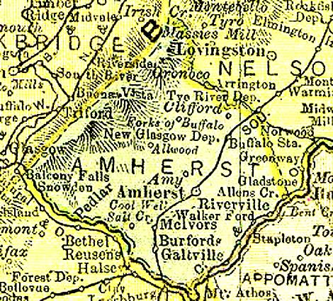
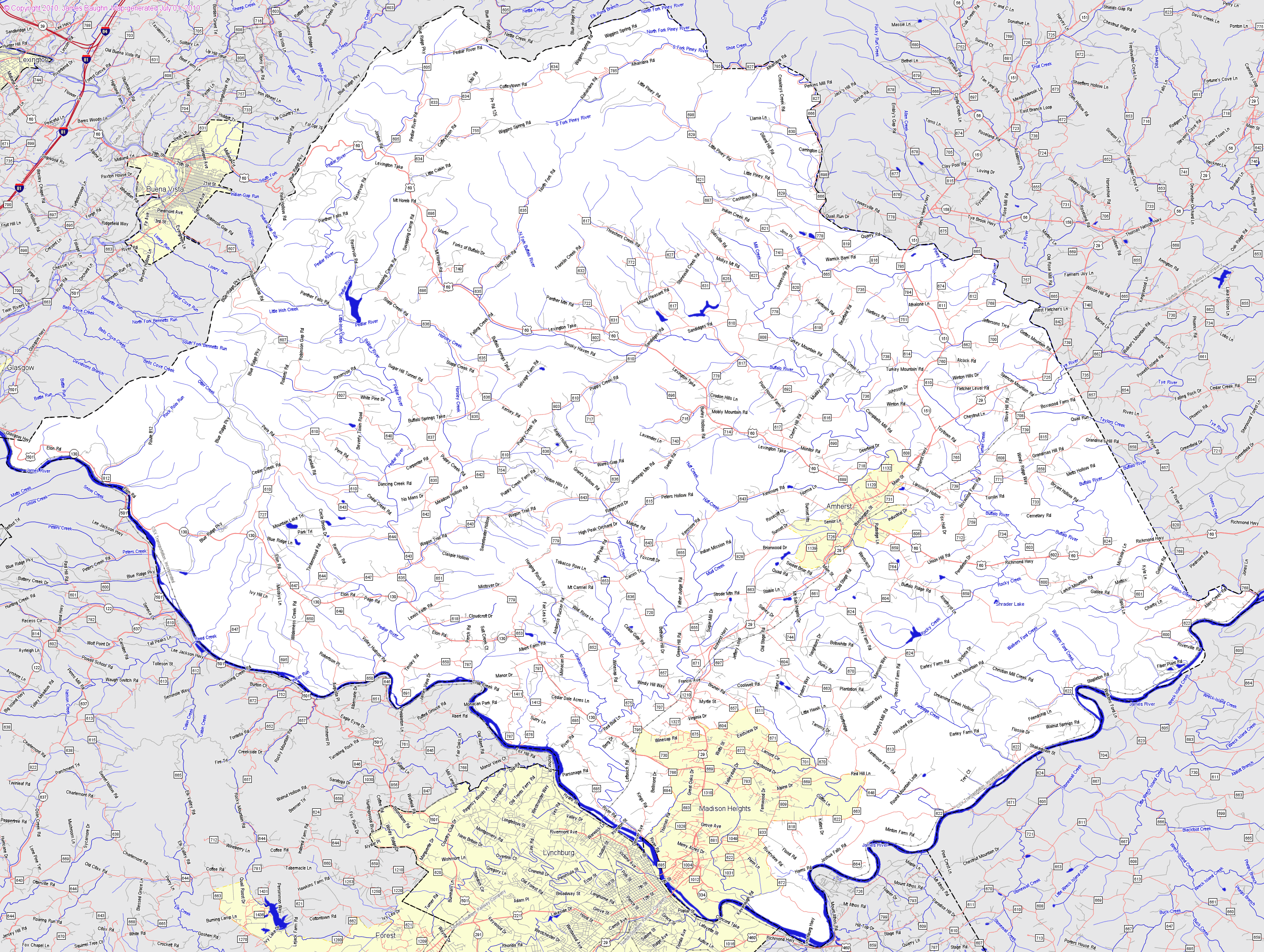
Amherst
County - 1895 - Amherst formed from Albemarle - 1761 - Source:
http://www.livgenmi.com/1895/ Back to Counties Information above
|
|
Amherst
Items
- From my Research File Back to Counties Information above 13 Apr 1789 - De-E-329, maybe error, F-G 1785-1796 - Shasteen, Jesse, wife Elinor and Elizabeth Wade, 50 A to Jacob Puckett for 35£, recorded in 1789 in land tax alterations pg 3 - North fork of Davises Creek, formerly owned by John Wade.James Cull's line...William Allen's part...Archibald Coffey's (Jesse married his widow Elinor) line...Samuel Denny dividing line...by a grave yard. Jesse and his wife received when Elinor’s first husband Archibald Coffey died (Source Virginia Chastains pg 134) 17 Jun 1799 - De-H-159, Part of H-I 1796-1802 - Shastead (& Shattead), Jas. 100 A from Ambrose Gatewood, Sr. & wife for 50£ (Prob James Jr. and wife Phoebe) - Same as below, plus on Otter Creek...to Jeremah Whitten line, to William Davis's new line crossing the big branch...to a white oak on a ridge. Wit Benjamin Shackleford, Thomas Jenkins, Roland Biass (sp?). Marginal Note in Index “1812 sent to James Shastead”. Why wasn't Phoebe on this deed? Bought by Senior, then given to Jr. and wife Phoebee by 1812 when they sold? Note in another source was “Orig. del. to JS on 18 Aug 1812” Perhaps This is James m Phoebe? (Source: Virginia Chastains pg 136) 19 Aug 1811 - Will book 5 page 66 - James Shasteen appt. guardian for Patsey Shasteen (?Chaskey?) - 15 May 1812 - Deed Book v U pg 117, Part of T-V 1829-1836 - James Shastead, Sen 130 A to John & R.S. Ellis for 70£ (a mercantile partnership) - Recording of this deed by Court in 1832 as result of suit by Richard S. Ellis surviving partner of the late mercantile concern of John & Richard S. Ellis plaintiff against William Davis and Robert Shastead, William Shastead, Edmund Shastead, Francis Shastead and Elizabeth Shastead, heirs at law of James Shastead dec'd, defendants. (Why not James b 1785? dead 1828-30 And does this mean these were alive in 1832 Robert James John dead by 1832? - Descript: on both sides of Otter Creek and the mill and all the premises belonging to the said land. The land adjoins the lines of WmDavis, Henry S Davies, decd and Robert Knuckles Sr for and in cconsideration of the sum of sevent pounds, the fee simple title..... Possession 1 Oct 1812 with privilege to seed this fall and make any buildings at any time forthwith, all the premises are to be well taken care of...Teste: Bennett Tinsley, Sandon Tuley, Linza Burks. - Note that both this property and the 100 A sold above were on the lines of Wm Davis and Robert Knuckles confirming the land was together and meaning that the two James' had at least about 230 acres together on Otter Creek in Southwest Amherst County probably very near the James River to have a mill but we only have purchase of 60 and 100.
12 Aug 1812
- De-L pg 279 -
Benjamin Noel, Amherst
Co., to William Davis Amherst..$100 100 acres Otter Creek.
Lines:
Big Branch Isaac
Tinsley,
James Shastead,
grantee - Deed
dated 12 Aug 1812 from Benjamin Noel, Amherst co., to William Davis,
Amherst Co, 100 acres on Otter Creek for $100. Lines: Big Branch, Isaac
Tinsley, James
Shastead,
grantee. Witnesses: Richard Tinsley, Robert Noel, Benjamin Shackelford,
Bennett Tinsley, Nelson Davis, Charles Davis, William Noel, Rodney
McCulloch (Source Val Burd: Also in Davis book page 62) |
|
Augusta
County - 1895 - Augusta formed from Orange - 1738-1745 - Source:
http://www.livgenmi.com/1895/ Back to Counties Information above
|
|
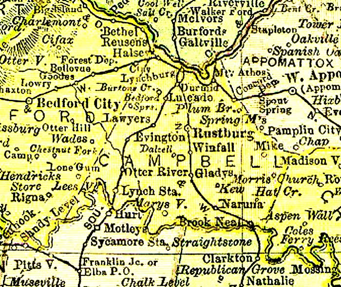
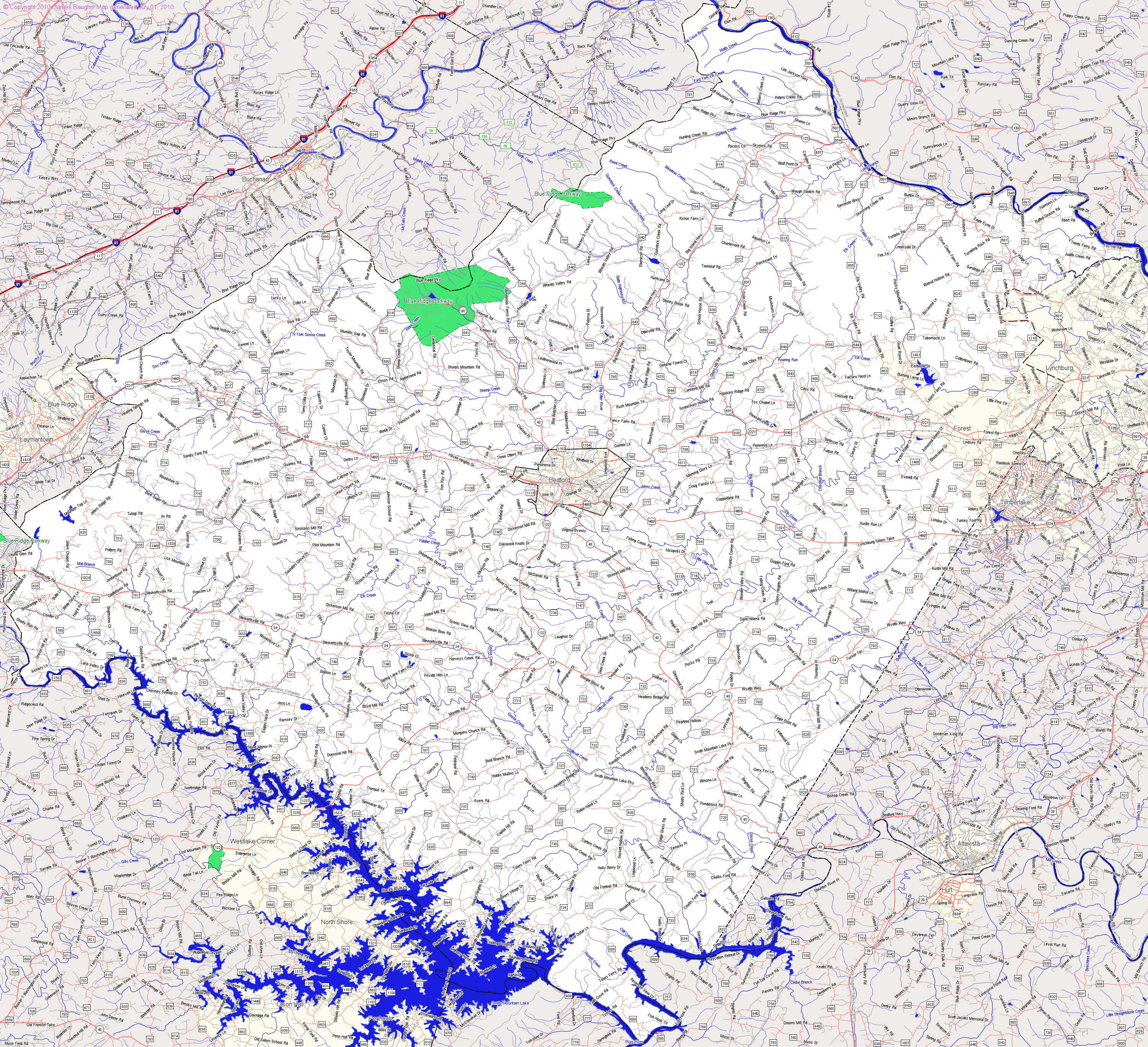
Bedford County - 1895 - Bedford formed
from Albemarle and Lunenburg - 1753-1754. In 1781-2 Campbell was formed from
eastern half of Bedford - Source: http://www.livgenmi.com/1895/ Back to Counties Information above
GPS Coordinates of present day
locations placed on
My Google
Map |
|
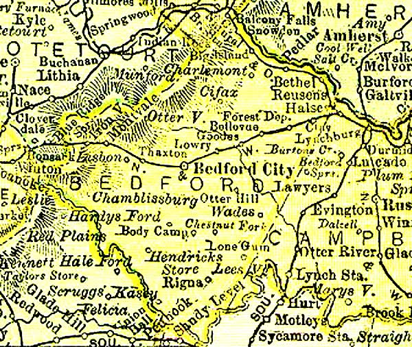
Bedford
Items - Note that much of historical SW Bedford is in present day Franklin
Co. as Franklin was formed out of the SW portion of Bedford Back to Counties Information above (RDS Is this Pierre Jr's son James Chasteen b 1740 VA the reverend that moved to Pendleton Co SC circa 1773 from Buckingham Co VA? page 151 Bedford Co. - "James Edens' land adjoined that of James Chastain in Bedford County. See Deed Book 6, page 311. This seems to verify that this is the Rev. James Chastain who travelled with James Edens to Tennessee to establish new churches. James Edens also moved to South Carolina about the same time as James Chastain." Source - VA Chastains, Lowell B Chastain pg 148 {Is this the only evidence that this land is the Rev. James Chastain?}) 18 Nov 1773 - Bedford - James Chasteen of Bedford County purchased 151 acres on the south side of the Otter River PRESENT DAY BEDFORD) from George Walton of Prince Edward County, VA. - This was about four years before John Chastain purchased land in Bedford County in 1777 Source - VGCFH pg 148 Bedford Co VA Deed Book 51 pg 213 - 24 Mar 1777 - Bedford - John Chastain Jr of Cumberland Co. bought 380 acres from James Boyd on the north fork of Otter river in Bedford County for 150 pounds [Bedford Deeds book 5, p. 468]. His will was proved in Bedford Co. on 28 Sept. 1807 [Bedford Will Book C, p. 160]. 15 Feb 1778 - Bedford - James Shasteen sold 15 acres to Ann Witt, it being part of 150 acres on which James now lived and which was conveyed to him by George Walton. on Otter River next to lines of William Reed and Thomas Robinson. It should be noted that John Chastain had a sister, Mary, who had married Benjamin Witt. Source - VGCFH pg 148 Bedford Co VA Deed Book 6 pg 12 18 Sep 1779 - Bedford - James Shasteen sold 50 acres on the south side of the Otter River on Thomas Robinson's line...corner on Moses Run (Mouth) to Lettice Brown of Bedford County. Witnesses Henry Brown, Francis Burks and Samuel Addams. Source: Miller file and VGCFH pg 148 Bedford Co VA Deed Book 6 pg 310 1779 - Bedford - James Chastain to Samuel Addams, south side of Moses Branch, a south branch of Otter River. On George White's line of John Roberts, James Edens and Samuel Adams. Witnesses: Richard Routon, John Routon and Mary Perrin. Source - VGCFH pg 148 Bedford Co. VA Deed Book 6, p. 311, 1779 Note: 13 Apr 1789 Amherst Co - Shasteen, Jesse, wife Elinor and Elizabeth Wade, sold 50 A to Jacob Puckett for 35£. Archibald Coffey's widoe (Jesse married his widow Elinor) line...Samuel Denny dividing line...by a grave yard. Jesse and his wife received when Elinor’s first husband Archibald Coffey died (Source Virginia Chastains pg 134) Note: Oct 1791 James and his brother Jesse moved to Madison County, KY Bedford 1 February 1780 - Author Link Witt, Benjamin. grantee. - Title Link Land grant 1 February 1780. - Source LVA Summary Location: Bedford County. Description: 700 acres on the head of Island and Falling Creeks. Source: Land Office Grants A, 1779-1780 (v.1 & 2 p.1-685), p. 281 (Reel 42). Part of the index to the recorded copies of grants issued by the Virginia Land Office. The collection is housed in the Archives at the Library of Virginia. 1751 - Chastain, Rene to John Givodan Source: VGCFH pg 132 1752 - Chastain, Rene from Robert Holt, 200 acres Source: VGCFH pg 132 1760 - Chastain, Rene to John Givodan, Personal Property Source: VGCFH pg 132 1761 - Chastain, Anne from James Ford, 100 acres. (Anne (Ford) Chastain was a daughter of James Ford. She married the Reverend Rene Chastain. Source: VGCFH pg 132 Tillotson Parish and St. Ann's Parishes are mentioned in the above listed deeds. Benjamin Harrison was a witness in one and the land was bounded by that of Joseph Adcock, Coleman Cary, Thomas Jabb, John Farrelson, Drury Mims and Benjamin Harrison. Source: VGCFH pg 133 START VGCFH pg 133/34 |
|
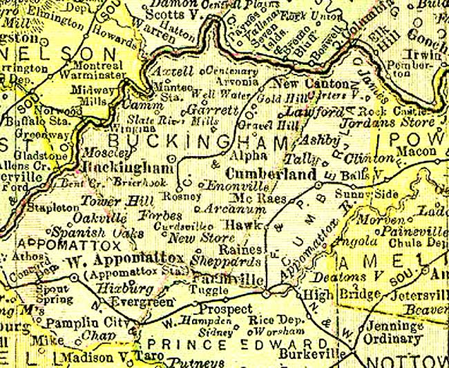
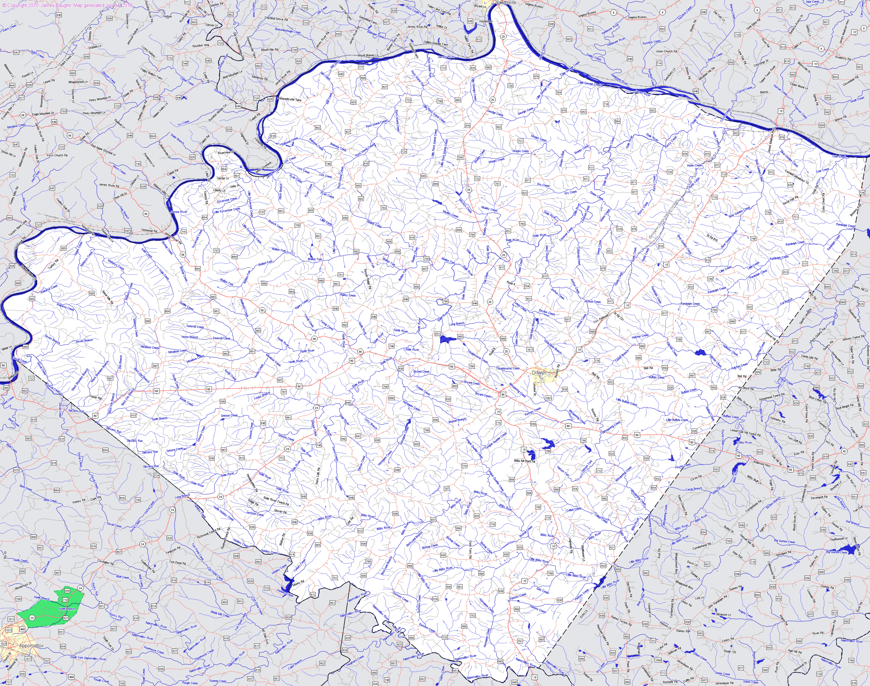
Buckingham
County - 1895 - Buckingham formed from Albemarle - 1761 -
Appomattox formed from Buckingham, Campbell, Charlotte, and Prince Edward - 1845
- Source:
http://www.livgenmi.com/1895/ - Buckingham Co., Courthouse: created in 1761, county court records were destroyed by fire in 1869. One plat book survived and some wills and deeds were later recorded. - See more at: http://www.genealogyinc.com/virginia/va-counties/#courthouse Back to Counties Information above
|
|
Buckingham Items
- From my Research File Back to Counties Information above 01 Dec 1740 Goochland now Buckingham - Pierre Chastain, Jr patented 400 acres in Goochland County on both sides of Hunt's Creek (VA Patent Book 19, p. 888) (Now Buckingham Co). 9 Aug 1799 - Buckingham -9 Aug 1799 Land Grant Author Link Chastain, Rane. grantee. - Title Link Land grant 9 April 1799..- Source LVA Summary Location: Buckingham County. Description: 68 acres on the waters of Greens Creek. (Present Albemarle Green Creek?) Source: Land Office Grants No. 38, 1797-1799, p. 563 (Reel 104). Part of the index to the recorded copies of grants issued by the Virginia Land Office. The collection is housed in the Archives at the Library of Virginia. |
|
Campbell
County - 1895 - Campbell formed from Bedford 1781-1782 - Source:
http://www.livgenmi.com/1895/ Back to Counties Information above
GPS Coordinates of present day
locations placed on
My Google
Map |
|
Campbell Items Back to Counties Information above |
|
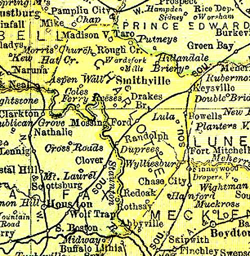
Charlotte County - 1895 -
Charlotte formed from Lunenburg - 1764-1765 - Source:
http://www.livgenmi.com/1895/ Back to Counties Information above
GPS Coordinates of present day
locations placed on
My Google
Map |
|
Charlotte Items Back to Counties Information above Charlotte -1 Aug 1772 Land Grant Author Link Chastain, Peter. grantee. - Title Link Land grant 1 August 1772..- Source LVA Summary Location: Charlotte County. Description: 69 acres on both sides of Bear Creek. Source: Land Office Patents No. 40, 1771-1772, p. 880 (Reel 39). Part of the index to the recorded copies of patents for land issued by the Secretary of the Colony serving as the colonial Land Office. The collection is housed in the Archives at the Library of Virginia. |
|
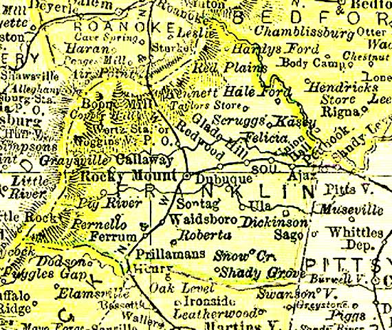
Franklin
County - 1895 - Franklin formed from
(SW) Bedford and Henry - 1785-1786 - Source:
http://www.livgenmi.com/1895/ Back to Counties Information above
|
|
Franklin Items - See Bedford Co also, as Franklin was formed
from SW Bedford 1785-86 Back to Counties Information above Note: As late as 1779, George Chastain was still present in his father's household (in the section of Henry County, Virginia, that would in 1786 become Franklin County). His name is also on a May 24, 1779, list of petitioners asking that this area become a new county. (Either his reported birth year of 1766 is not accurate or else George signed the petition as a teenager – or both.) He was a taxpayer in Franklin County on July 16, 1791, and on August 18 in that year he and Rebecca were married in this same county.2 George and Rebecca's property was situated on the west bank of Little Otter Creek (See the USGS maps for Endicott/Virginia and Ferrum/Virginia for the Little Otter Creek area.), where they first purchased 168 acres on April 11, 1794, and then another 80 acres on December 22, 1801. The latter purchase was made from Thomas and Lucy Staton of Buckingham County, Virginia, not the Thomas and Ann Staton who, we believe, were Rebecca's parents; the exact family relationship of these Statons is not clear. George Chastain was an active member of the Pigg River Baptist Church, a church that also counted among its members the Staton family we will meet a little later in this chapter. On September 1, 1803, George and Rebecca sold their 248 acres in Franklin County. Either then or during the next spring, they moved to Kentucky, where several of George's brothers had already gone to live. Source: http://www.donnneal.com/chastain-staton-soblet.html#as Note: Source: PCAHDI pg 36 - The personal tax lists of Franklin Co in 1788 named William Chastain (RDS note: b circa 1744, son of Pierre Jr. b circa 1707) with two white males over 16 and in 1789 and 1790. The lists named three free white males over 16. In 1791, the names of George and Valentine Chastain appeared in 1792, Robert Chastain's name appeared; in 1795, Barnett Chastain's name first appeared, and, in 1796, Ren Chastain made his first appearance on the tax lists. Ren last appeared on the Franklin County lists in 1797, Robert and Barnett in 1801, Valentine in 1802, and George in 1803. After 1803, there were no Chastains on the tax list of Franklin Co VA." (RDS note re ages: George and Valentine 1791-21 = 1769, Robert 1792-21 =1771, Barnett 1795-21=1774, Ren 1796-21=1775. This compares to PCAHDI info of circa 1766, abt 1768, abt 1770, abt 1774, abt 1776 - not significantly off.) |
|
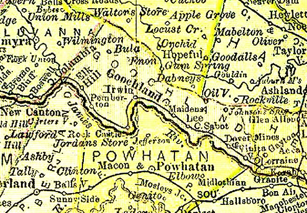
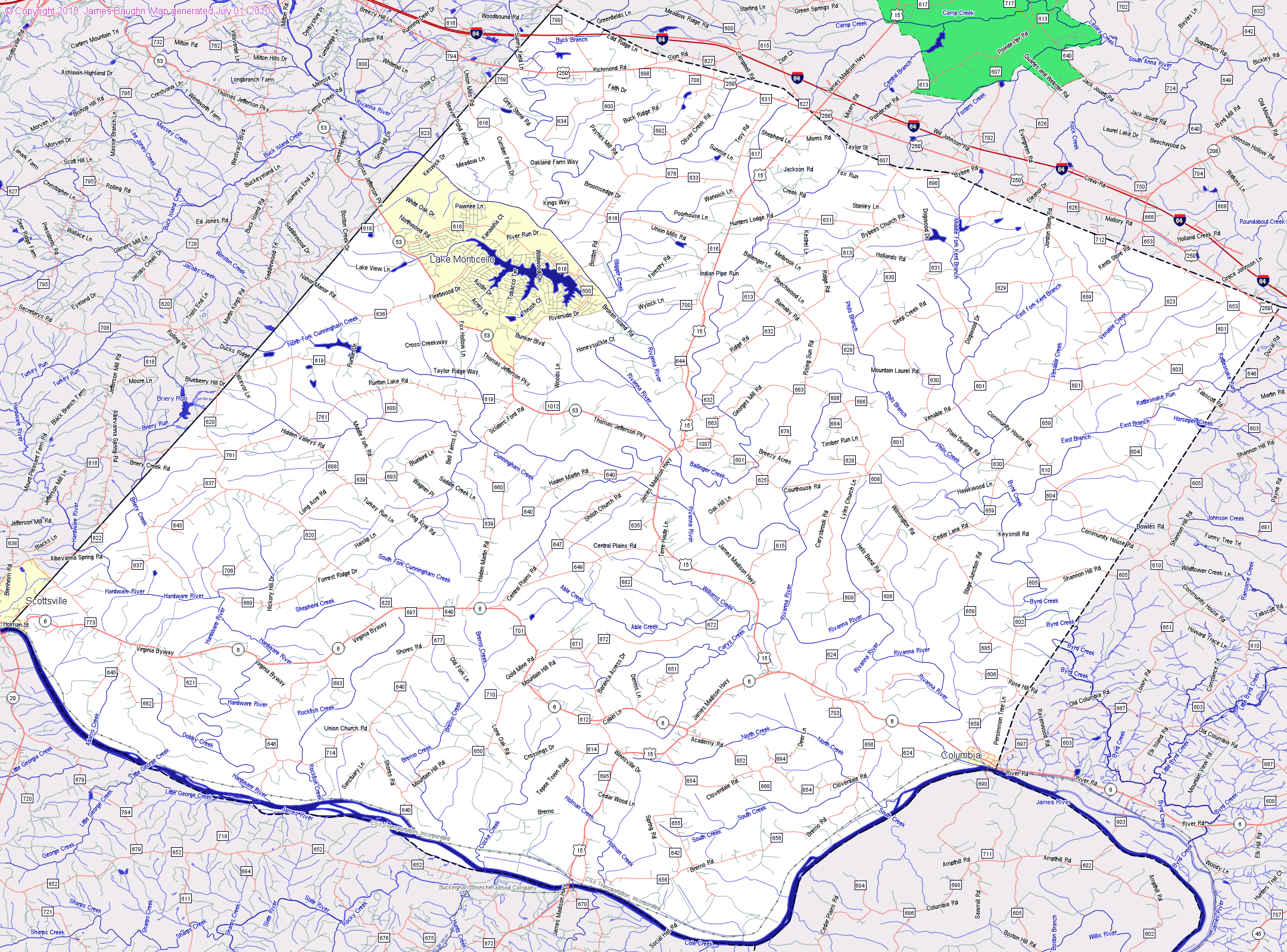
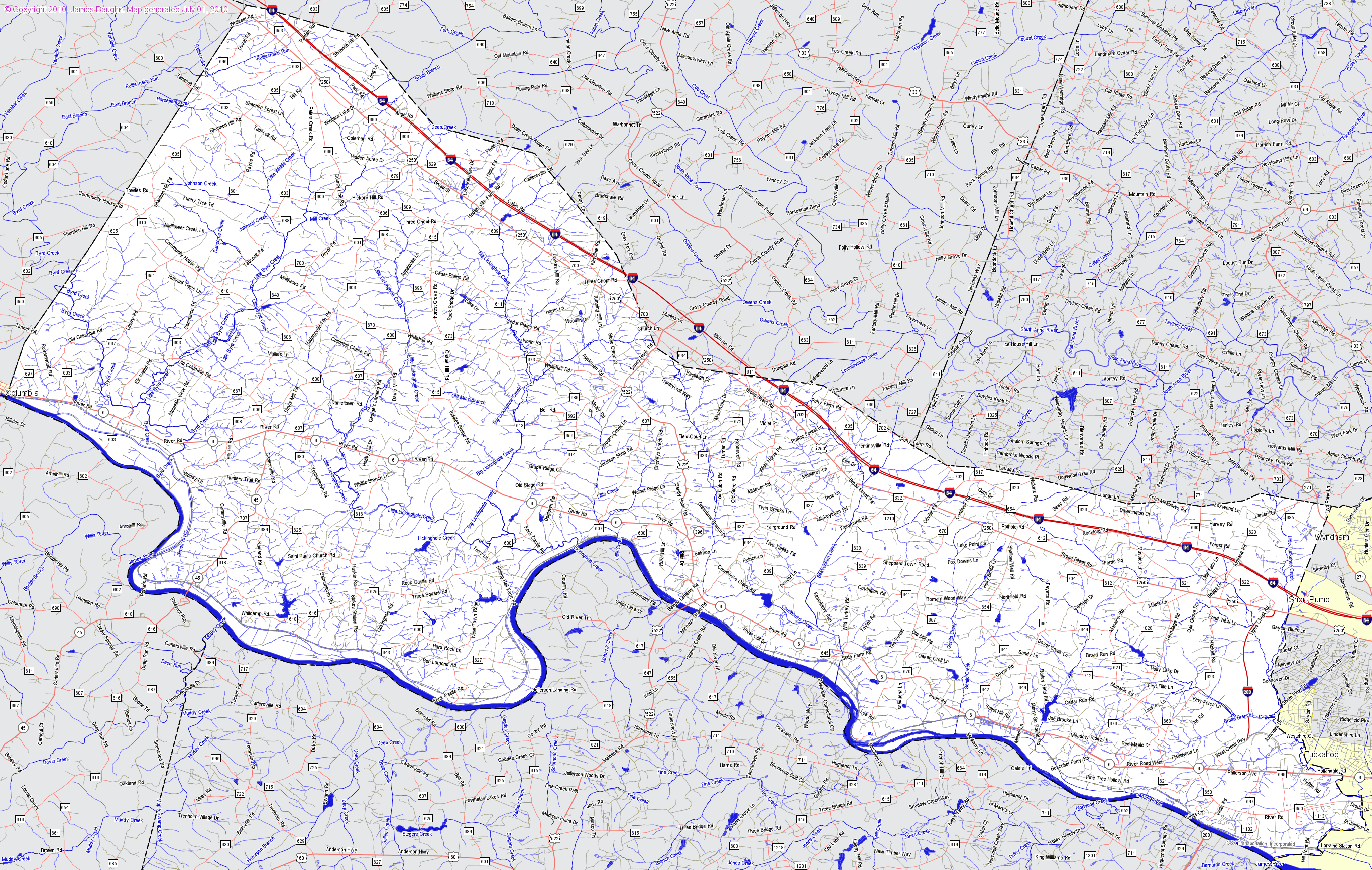
Goochland
County - 1895
- Goochland formed from Henrico - 1728 - Source:
http://www.livgenmi.com/1895/ Back to Counties Information above
GPS Coordinates of present day
locations placed on
My Google
Map |
| Goochland
Items - See also
Stephen Chastain
Notes for Land Grants Back to Counties Information above Goochland - 15 Dec 1737 Land Grant Author Link Chastain, John. grantee. - Title Link Land grant 15 August 1737..- Source LVA Summary Location: Goochland County. Description: 112 acres on the east branches of the Lower Manacan Creek. Source: Land Office Patents No. 17, 1735-1738, p. 406 (Reel 15). Part of the index to the recorded copies of patents for land issued by the Secretary of the Colony serving as the colonial Land Office. The collection is housed in the Archives at the Library of Virginia. Goochland 16 Jun 1744 - Witt, Benjamin. grantee. - Title Link Land grant 16 June 1744. - Summary Location: Goochland County. - Source LVA Description: 200 acres on both sides of Hunts Creek a branch of Slate River. Source: Land Office Patents No. 22, 1743-1745 (v.1 & 2 p.1-631), p. 111 (Reel 20). Part of the index to the recorded copies of patents for land issued by the Secretary of the Colony serving as the colonial Land Office. The collection is housed in the Archives at the Library of Virginia. Goochland - 1 Dec 1740 Land Grant Author Link Chastain, Peter. grantee. - Title Link Land grant 1 December 1740..- Source LVA Summary Location: Goochland County. Description: 400 acres on both sides of Hunts Creek a branch of Slate River. Source: Land Office Patents No. 19, 1739-1741, p. 888 (Reel 17). Part of the index to the recorded copies of patents for land issued by the Secretary of the Colony serving as the colonial Land Office. The collection is housed in the Archives at the Library of Virginia. Goochland - 15 Dec 1749 Land Grant Author Link Chastain, Rene. grantee. - Title Link Land grant 15 December 1749..- Source LVA Summary Location: Goochland County. Description: 400 acres on Pidey Rock of Willis’s River. Source: Land Office Patents No. 29, 1749-1751 (v.1 & 2 p.1-532), p. 70 (Reel 27). Part of the index to the recorded copies of patents for land issued by the Secretary of the Colony serving as the colonial Land Office. The collection is housed in the Archives at the Library of Virginia. Goochland - 1 Jun 1750 Land Grant Author Link Laforce, Rene. grantee. - Title Link Land grant 1 June 1750..- Source LVA Summary Location: Goochland County. Description: 900 acres on the south side of James River between Chastain and Dutoits Branches. Source: Land Office Patents No. 30, 1750-1752, p. 142 (Reel 28). Part of the index to the recorded copies of patents for land issued by the Secretary of the Colony serving as the colonial Land Office. The collection is housed in the Archives at the Library of Virginia. |
|
Henrico
County - 1895 - Henrico
formed as one of eight original "shires" - 1634 -
partial destruction of Henrico County records during the Revolution -
Source:
http://www.livgenmi.com/1895/ Henrico Co., Courthouse: created in 1634 as an original shire, all county court records prior to 1655 and almost all prior to 1677 are missing; additionally, many isolated records were destroyed during the Revolutionary War, and almost all Circuit Court records were destroyed by fire in Richmond on 3 April 1865. - See more at: http://www.genealogyinc.com/virginia/va-counties/#courthouse Back to Counties Information above
|
| Henrico
Items- See also Stephen Chastain
Notes for Land Grants, Will Back to Counties Information above Henrico - 23 March 1715 Land Grant . Author Link Chastaine, John. grantee. - Title Link Land grant 23 March 1715. - Source LVA - Summary Location: Henrico County. Description: 90 acres on the south side of James River begg. &c. standing on the river, parting the said Chastaine and Jacob Amonet. Source: Land Office Patents No. 10, 1710-1719, p. 267 (Reel 10). Part of the index to the recorded copies of patents for land issued by the Secretary of the Colony serving as the colonial Land Office. The collection is housed in the Archives at the Library of Virginia. Henrico - 23 March 1715 Land Grant Author Link Chastaine, Peter. grantee. - Title Link Land grant 23 March 1715. - Source LVA - Summary Location: Henrico County. Description: 111 acres on the south side of James River, adjoing Anthony Malloone and his own land. Source: Land Office Patents No. 10, 1710-1719, p. 266 (Reel 10). Part of the index to the recorded copies of patents for land issued by the Secretary of the Colony serving as the colonial Land Office. The collection is housed in the Archives at the Library of Virginia. Henrico - 09 July 1724 Land Grant Author Link Chastain, Peter, Capt. grantee. - Title Link Land grant 9 July 1724. - Source LVA - Summary Location: Henrico County. Description: 379 acres 1r. 1Opo, - On the west side Jones’ Creek. Source: Land Office Patents No. 12, 1724-1726, p. 15 (Reel 11). Part of the index to the recorded copies of patents for land issued by the Secretary of the Colony serving as the colonial Land Office. The collection is housed in the Archives at the Library of Virginia. Henrico - 24 Mar 1725 Land Grant Author Dupuy, Francis. grantee. - Title Link Land grant 24 March 1725. - Source LVA - Summary Location: Henrico County. Description: 200 acres on the south side of James River, beginning at the fork of Shastains and Ditways Branches. Source: Land Office Patents No. 12, 1724-1726, p. 405 (Reel 11). Part of the index to the recorded copies of patents for land issued by the Secretary of the Colony serving as the colonial Land Office. The collection is housed in the Archives at the Library of Virginia. - Other Format Available on microfilm. Virginia State Land Office. Patents 1-42, reels 1-41. |
|
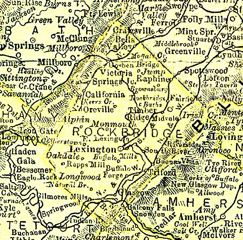
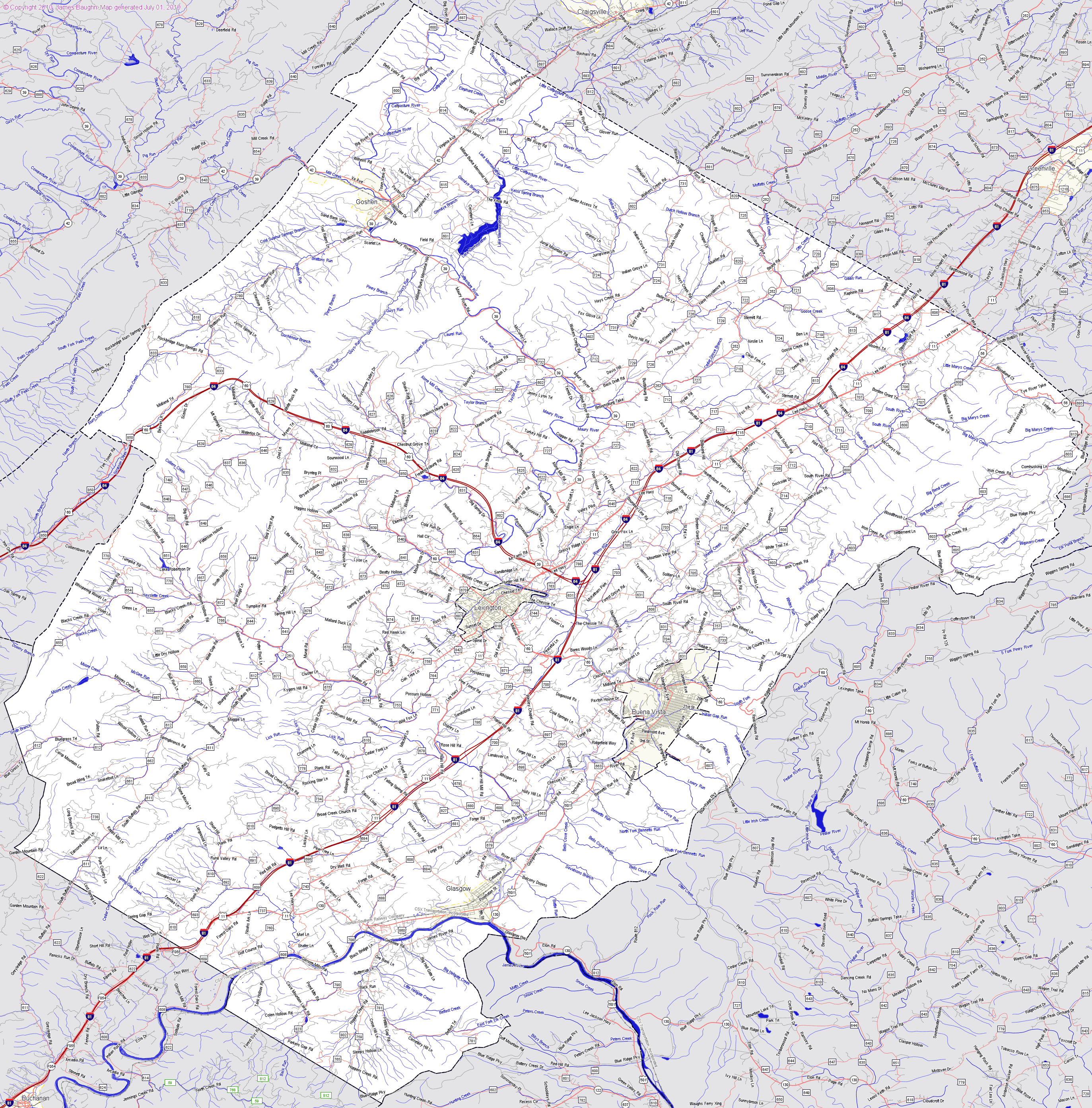
Rockbridge County - 1895
-
Rockbridge formed 1778 from Augusta and Botetourt
- Source:
http://www.livgenmi.com/1895/ Back to Counties Information above
|
|
Out of State Back to Counties Information above GPS Coordinates of present day locations placed on My Google Map Kentucky 27 Oct 1789 - Probably Rene Chastain, Sr b abt 1776 VA d 1860 Vernon Twpship, Moved to Henry Co KY Washington Co IN on Tax lists Franklin Co VA 1796, 1797, taxes rolls Shelby Co KY 1802 - see Otter pg 157 (son of William b 1744 who was son of Peter b 1707) Author Link Shastem, Ranney. grantee. Title Link Land grant 27 October 1789 .- Source LVA Summary Location: Bourbon County (Ky.). Description: 600 acres on Slate Creek a south west branch of Main Licking. Source: Land Office Grants No. 22, 1789-1791, p. 13 (Reel 88). Part of the index to the recorded copies of grants issued by the Virginia Land Office. The collection is housed in the Archives at the Library of Virginia. Other Format Available on microfilm. Virginia State Land Office. Grants A-Z, 1-124, reels 42-190; Virginia State Land Office. Grants 125- , reels 369-. |
![]()
Copyright © 1995-2015, All rights reserved