JAMES "BUFF" SHASTEEN
(SHARSTEAD / SHASTEAD / CHASTAIN)
Of Amherst County, VA b circa 1725-30
![]()
JAMES "BUFF" SHASTEEN
(SHARSTEAD /
SHASTEAD / CHASTAIN)
Of Amherst County, VA b circa
1725-30
![]()
|
This section is dedicated to research
regarding the paternity of
James "J River" Shasteen
(Shastead / Chastain) (b circa 1755-60 d est 1813-1819 VA or OH) who
married Phoebe Padgett 18 Apr 1782 in Amherst Co., VA (b est 1760-65 d est
1813-1829 VA or OH). He is referred to as James "J River" on the
property tax rolls and I feel I have without a doubt proven he is the father of
the five sons Robert, James, William, Edmond, and John on those rolls. Our lineage was traced back
from Ohio using the personal property tax rolls of Amherst County VA for the
period from 1785-1814 and the the 1810 Federal Census records for Amherst and
Rockbridge Counties, Virginia. |
|
James "Buff" Shasteen as father of James "J River" Shasteen
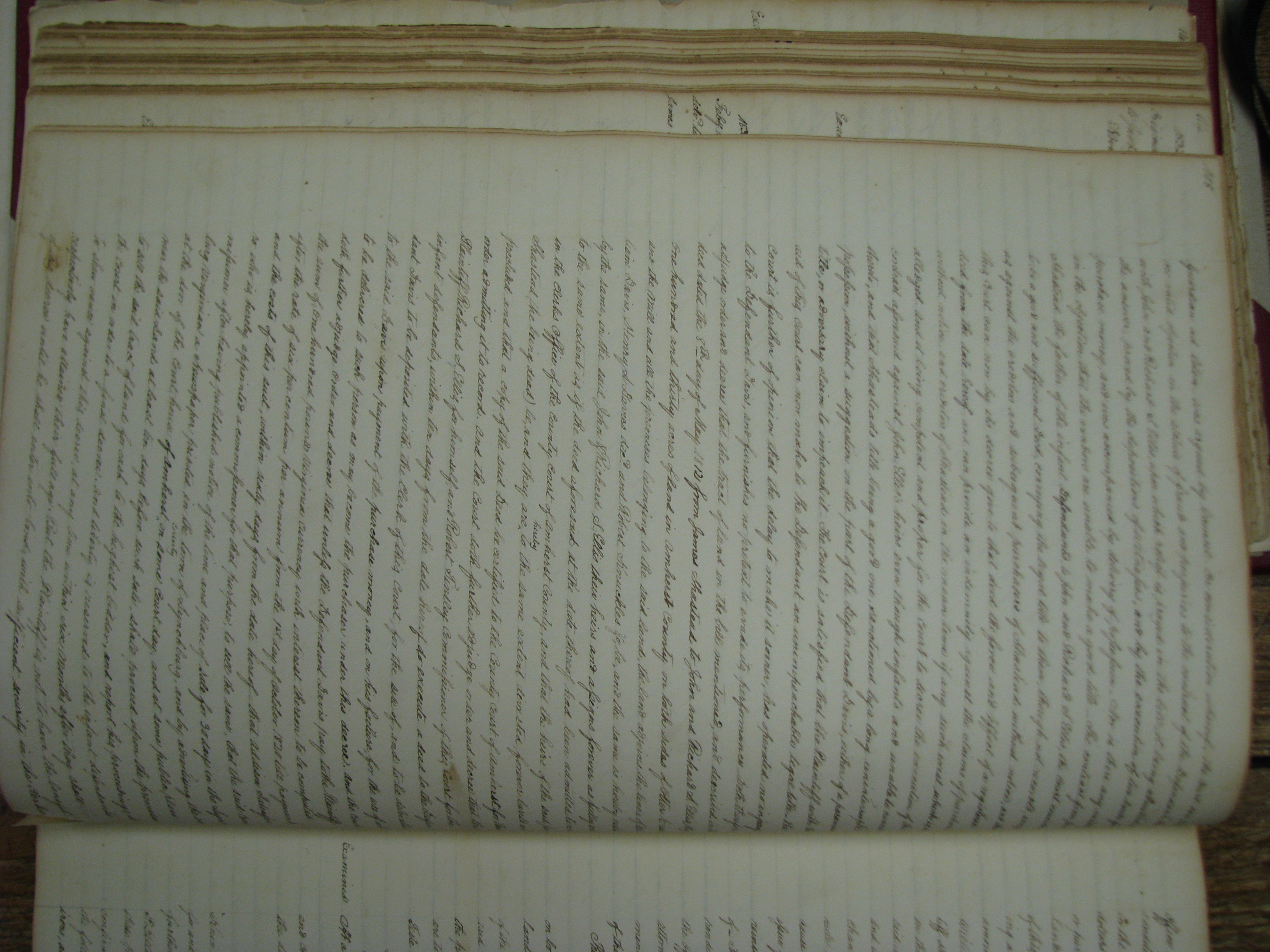
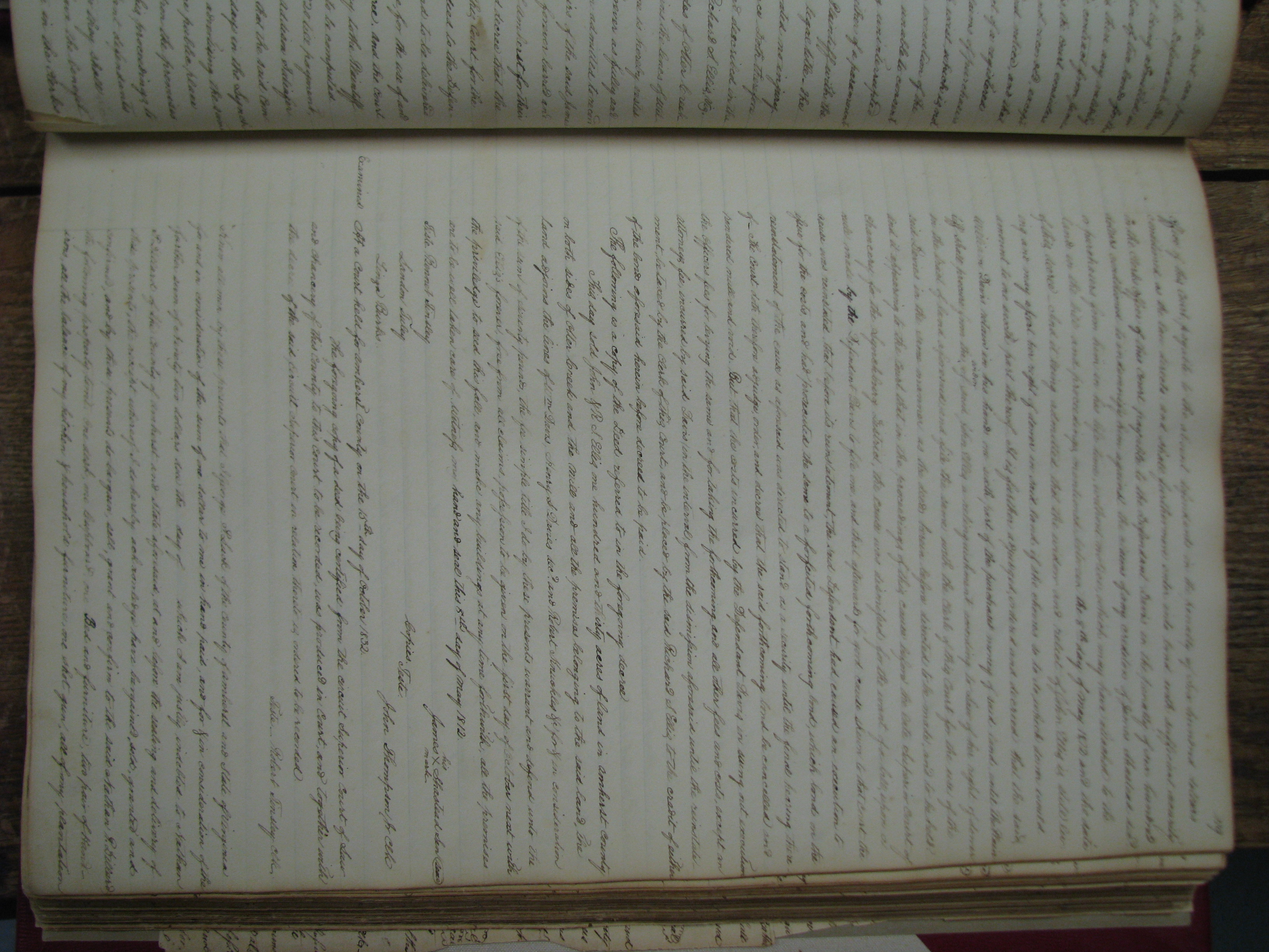
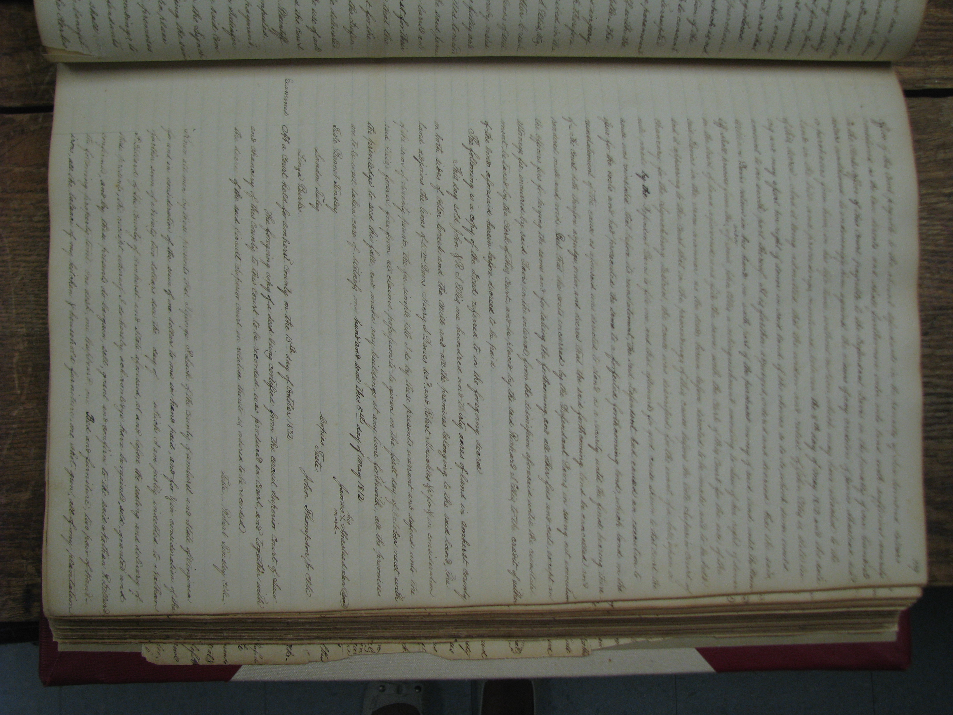
Part of the logic behind my assertion assertion that James "Buff" is father of "James J River," that "James Buff" lived until 1812 to sell the 130 A while both he and his son James "J River" were deceased by 1832 in the suit pertaining to the 130 acres, includes many of the following (basically a timeline of appearances of likely Shasteen all spellings occasions, summarized below or on other pages):
This leaves the
brothers Jesse
and James "Pedlar" Shasteen unplaced and available as previously
unknown descendants of someone like
Isaac
Chastain (b 15 Mar 1734). See
below. |
|
Discussion of Placement of James "Buff" Shasteen
Also on these tax rolls are the brothers Jesse Shasteen (married Eleanor Wade Coffee) and James "Pedlar" Shasteen (married Nancy Kennedy) who are documented as having moved to Kentucky circa 1790/91 and whose lines are well documented. Lastly, there are entries for James "Buff" Shasteen in 1791 and 1792, who I assert below to be older than James "J River", Jesse, and James "Pedlar" Shasteen, and the father of James "J River" Shasteen. The question is, if indeed James "Buff" is older, how can he be the father of brothers Jesse Shasteen and James "Pedlar" Shasteen AND James "J River" Shasteen? The simple thought is that is unlikely. He would have had to adopt either the brothers or James "J River" Shasteen. If James "Buff "were born circa 1727-1730, "J River "born 1755-60, Jesse born 1755,and James "Pedlar" born 1761 - James "Buff "could have married (Elizabeth, see 1749 deeds) circa 1748 who was the mother of James "J River" circa 1755, perished and then James "Buff "could have remarried a woman circa after 1755 with very young children Jesse and James "Pedlar". (Or this could be reversed where the brothers were born first and J River was the second wife's already born son.) The more likely scenario would be the three younger men were cousins of some sort and James "Buff" and another comparably aged and undocumented Shasteen were related into the Chastain clan through some missing link. If you posit James "Buff" was born somewhere around 1727 he could fit in the following:
• Could be the James Chasteen,
Sr
(see Military Service below) in the muster rolls of
Capt. Beverly Robinson raised in the Colony of Virginia born circa 1730/31 |
|
Files Pertinent to this Research
|
| Other Sources & Items | |
|
Early Military Service Source: Kim Shasteen |
1739-1748 -- King George's War
-- List: James Chastaine "The following are the muster rolls of the company of foot of Captain Beverley Robinson raised in the colony of Virginia in 1746 for an expedition against Canada. The company was part of a larger force under the command of George Clinton, Captain General and Commander in Chief of the Province of New York. Lieutenant Joseph Harmer was left sick at New York and Ensign John Sloss was not returned. The original records are in the Public Record Office, London, CO5/1338." Robinson's Virginia Militia 1746 - Muster Roll of Captain Beverly Robinson's Co. in Virginia 15 Chastain, James enlisted 28 July 14 June 1746 - 24 Aug 1746 15 Chastain, James 25 Aug 1746 - 24 Oct 1746 14 Chastain, James 25 Oct 1746 - 24 Dec 1746 Chastain James 25 Dec 1746 - 23 Feb 1747 Chastain James 24 Feb 1747 - 24 Apr 1747 Chastaine James 25 June 1747 - 24 Aug 1747 13 Chastine, Jas 25 Aug 1747 - 24 Oct 1747 13 Chastaine, Jas 24 Oct 1747 - 24 Nov 1747 Note period is continuous from Jun 1746 to Nov 1747. Also, Morgan Conway preceeds the Chastain name of each spelling, so would assume it is the same James in each instance. Virginia's Colonial Soldiers - King George's War The following are the muster rolls of the Co. of foot of Capt. Bev Robinson Returns for 14 June 1746 - 24 Aug 1746 - James Chastain 28 July Returns for 25 Aug 1746 - 24 Oct 1746 - James Chastain Returns for 25 Oct 1746 - Nov 1746 - James Chastine Returns for 25 Dec 1746 - 23 Feb 1747 - James Chastain Returns for 24 Feb 1747 - 24 April 1747 - James Chastain Returns for 25 June 1747 - 24 Aug 1747 - James Chastaine Returns for 25 Aug 1747 - 24 Oct 1747 - James Chastine * Thomas Wade is listed with James on every roll call, no other obviously Chastain related names noted. Wade potentially related to Elenor Wade Coffee that married Jesse Shasteen Virginia Colonial Soldiers Pertinent Pages.doc - Source: Virginia’s Colonial Soldiers by Lloyd DeWitt Bockstruck |
|
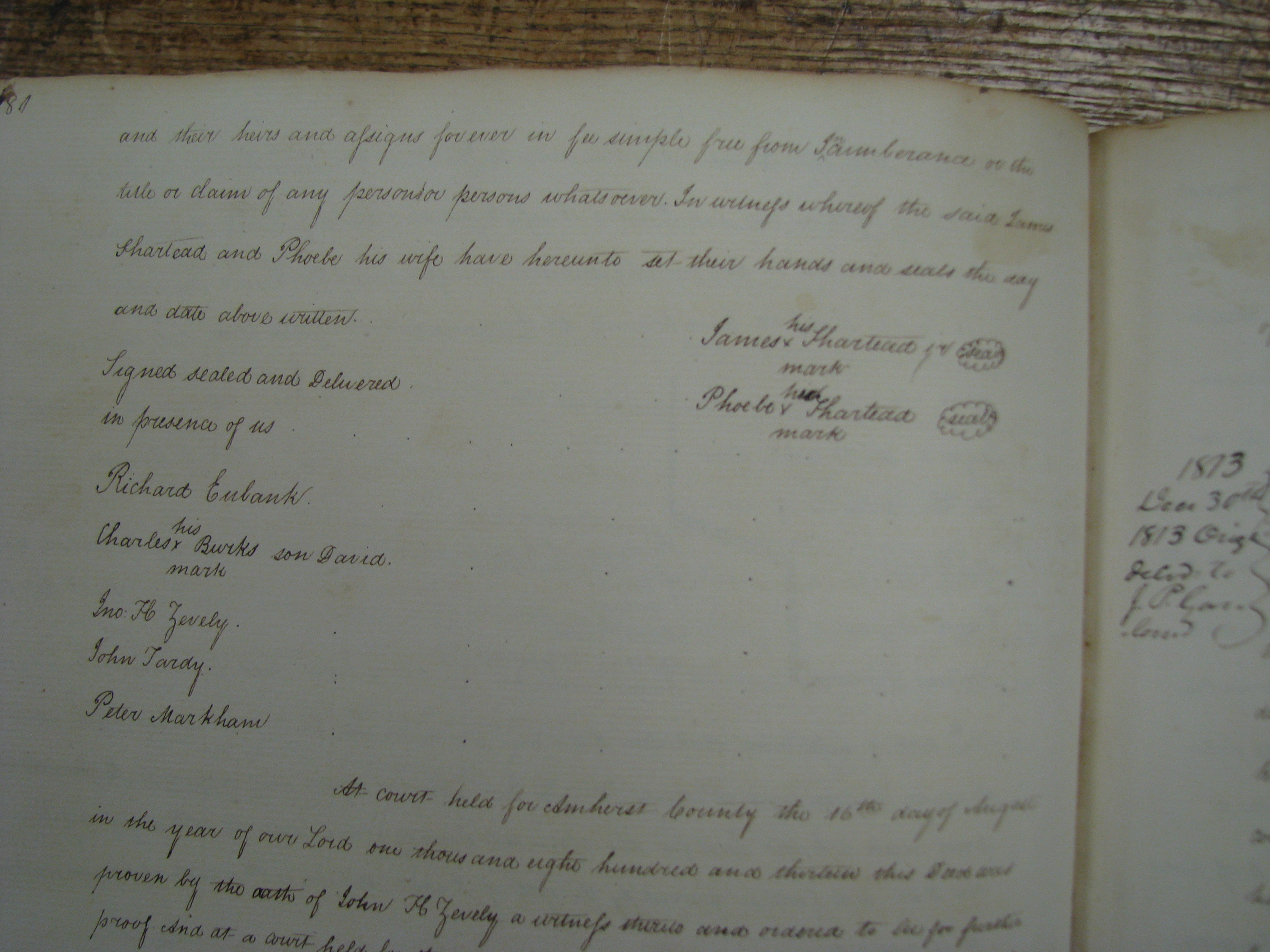
10 April 1748 Albemarle County, Va |
Case of Bishop Toney and Sarah
his wife against James Shasted, saying that on 10 April 1748 he said that
Sarah Toney was "Thomas Lane's Whore" and that he would prove it. Toney's claim
damages of 50 pounds. Order to summon William Bishop and Rachel Jones as wittnesses for James Chasted. 13 July 1749 to Justices of Albermarle County Court: "Please let my suit against James Shasted be dismist." Signed Bishop Toney Source: Kim Shasteen - (3 items~ Albemarle County, Va Court Papers 1744-1783) |
|
1 April 1749 Land Grants Bishop Toney |
Toney, Bishop. grantee. - Land
grant 1 April 1749. - Albemarle County - pg 576 Description: 99 acres for 10 shillings - the south side of the Fluvanna. On Benjamin Mims line along the Grassy Patch Creek Source: Land Office Patents No. 28, 1746-1749 (v.1 & 2 p.1-730), p. 576 (Reel 26). Part of the index to the recorded copies of patents for land issued by the Secretary of the Colony serving as the colonial Land Office. The collection is housed in the Archives at the Library of Virginia. Toney, Bishop. grantee - Land grant 1 April 1749 - Albemarle County - pg 575 Description: 150 acres for 15 shillings adjoining the south side of the Fluvanna River., no further geographic description except on river bank Source: Land Office Patents No. 28, 1746-1749 (v.1 & 2 p.1-730), p. 575 (Reel 26). Part of the index to the recorded copies of patents for land issued by the Secretary of the Colony serving as the colonial Land Office. Th |
| Bishop Toney Other |
Albemarle 1789 PersonalA pg 18 Tax Lists -
1 Negro ab 16, 1 bet 12-16, 1 horse Several non definitive Ancestry family trees such as http://quickening.zapto.org/gramps/ppl/3/3/ab7f09846dd371e8533.html Jesse Toney, son of Bishop Toney, was a member of CPT Holman Rice's company during the Revolutionary War. (not verified, but this is the same unit as James and Jesse Shasteen) Source: http://genforum.genealogy.com/toney/messages/1282.html I show that Bishop Toney was also the father of the John Toney (born about 1756 in Goochland Co., VA) who married Mary Fletcher. (posted in response) |
|
10 Mar 1756 Albemarle Land Grand William Bishop |
Bishop, William. grantee - Land
grant 10 March 1756 - Albemarle County. Description: 123 acres on the south branch of hardware River. Source: Land Office Patents No. 34, 1756-1765, p. 59 (Reel 33-34). Part of the index to the recorded copies of patents for land issued by the Secretary of the Colony serving as the colonial Land Office. The collection is housed in the A Note Personal Property, none Albemarle, mostly Surry South Fork Hardware River - Albemarle - 37.9173635 -78.5505683 Mouth — 37.949307 -78.7311305 Source |
|
Early Military Service 28 June 1746 to 24 November 1747 |
FROM THE CHESTNUT TREE, Vol. XIV, #3, p. 21 ("Virginia Colonial
Soldiers" by Lloyd DeWitt Bockstuck)
-Muster rolls of a company of Foot officers, Capt. Beverly Robinson
raised in the Colony of Virginia in 1746 for an expedition against Canada
during King George's War 1739-1748.
-Originals in the Public Record Office, London Company 5/1338
-James Chastain/Chastaine/Chastine enlisted 28 Jun 1746
-Shown on returns:
25 Aug - 24 Oct 1746
25 Oct - 24 Dec 1746
25 Dec 1746 - 23 Feb 1747
25 Jun -25 Aug 1747
25 Aug 1747- 25 Oct - 25 No 1747
SOURCE: BLPossibly the James Chastain (also Chastaine and Chastine) in the Muster Rolls of a Company of Foot of Capt. Beverly Robinson raised in the Colony of Virginia in 1746 for an expedition against Canada. The company was part of a larger force under the command of George Clinton, Captain General and Commander in Chief of the Province of New Yourk. Lieutenant Joseph Harmer was left sick at New Yourk and Ensign John Sloss was not returned. The original records are in the Public Record Office, London, CO5/1338. during King George's War 1739-1748: (Originals in Public Record Office, London. co 5/1338). ...enlisted 28 June 1746 and is (shown on returns for periods 14 June 1746-24 August 1746, 25 August-24 October 1746, 25 October-24 December 1746, 25 December 1746-23 February 1747, 24 February-24 April 1747, skip two months, 25 June-24 August 1747, 25 August-25 October 1747 and 25 October-24 November 1747.) SOURCE: TCT July 1989 page 21 submission by Violet Cook and ancestry.com "It seems possible that the father of the Shasteens who migrated to Ohio was James Chasteen, Sr., born not later than 1730 because he is listed eight times, from June, 1746 through November, 1747, on the Muster Roll of the Virginia Militia. To have been a member of the Militia, he would have to been born not later than 1730 since the minimum age for service was 16. He seems to have lived throughout his life in Amherst and Rockbridge Counties, Virginia. It is well to note that the different spellings of Shasteen were used at random. One speculation is that James Chasteen could be the son of Pierre "Peter" Chastain who was born in France in 1663 and died in Virginia in 1761. Several other descendants were told that the family was of Irish origin. Many Irish immigrants settled in the Shenandoah Valley." SOURCE: Chapter 8 of Martha Gerber Rittenger book – Schlager/Slager Family History King George's War (1744–1748) is the name given to the military operations in North America that formed part of the War of the Austrian Succession (1740–1748). It was the third of the four French and Indian Wars. It took place primarily in the British provinces of New York, Massachusetts Bay, New Hampshire, and Nova Scotia. Its most significant action was an expedition organized by Massachusetts Governor William Shirley that besieged and ultimately captured the French fortress of Louisbourg, on Cape Breton Island in Nova Scotia, in 1745. SOURCE: Wikipedia.org Background - http://www.ancestry.com/wiki/index.php?title=Virginia_Military_Records |
| Military Service |
James Shasteen (spelling from Ancestry
entry) - Birth Date: 1740 -
Birthplace: Virginia - Volume: 156 - Page Number: 496 - Reference:
Historical reg. Of Virginians in the Rev., soldiers, sailors and marines,
1775-1783. Ed. By John H. Gwathmey. Richmond, Va. 1938. (13, 872p.):703. Godfrey
Memorial Library, comp..American Genealogical-Biographical Index (ADBI)
[database on-line]. Provo, UT, USA Need to attempt to get a copy of this reference to see what is actually printed. Source: Ancestry.com A second reference pulled up James, James and Jesse. The question is where the birth year came from |
| Email Summary 4/2014 re James Buff, JRiver, Ped and Jesse Shasteen ancestors and relationship |
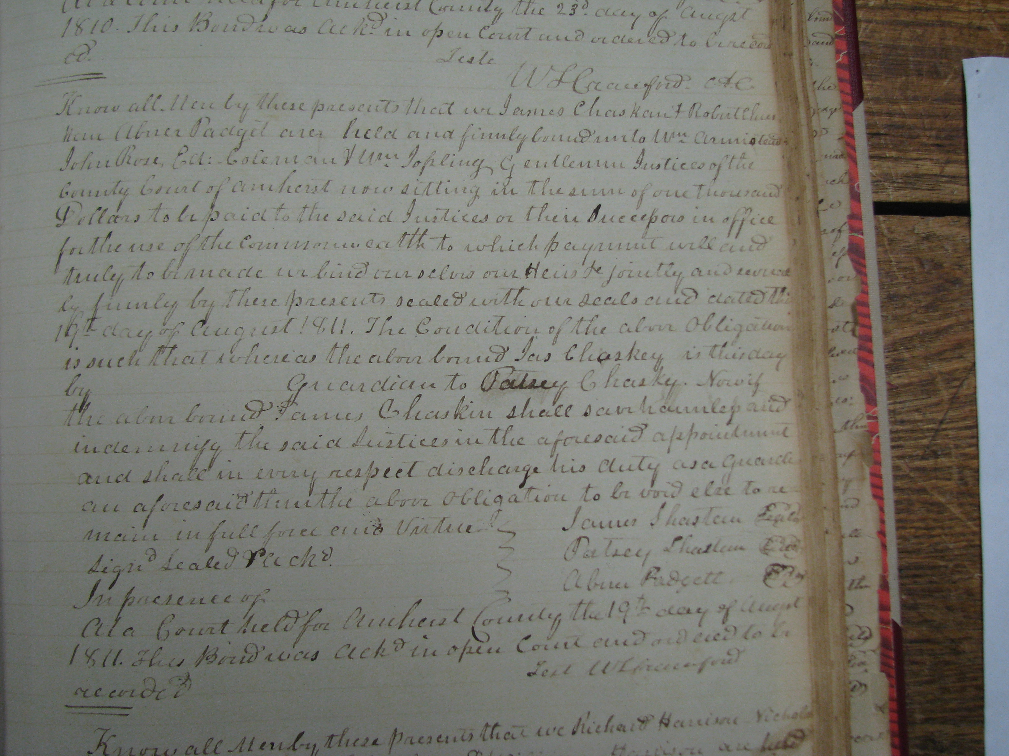
1. In 1700's according to one source, bastard children retained the last name of the mother - found one female Chastain with bastard child, referenced in the PCFA I book, perhaps I need to attempt to delve more into the early Chastain women? Do you know of any anecdotal evidence of same? 2. In 1700 and early 1800 guardianships, primarily for children, and not for their care, but for the protection of their assets. After 14, the child could pick guardian. Guardians apparently also turned down the job if assets too valuable. Bonds, as best I can tell, were promises to pay, not deposits. Regarding the 1811 guardianship I have been looking at for 20 years, 1) no indication for a minor 2) appears the person being "guarded" Patsey, signed the document 3) no indication of any follow up.
Question: Would the
courts have followup papers I have not seen? 3. Apparently middle names did not come to common usage until the late 1800's in Europe and US, particularly for the less affluent. Yet we have a lot of them in the early Chastain lines. Wonder why? More affluent?
4. Jean / Jacques /
John / James - What is the likelihood that between the French
enunciation and the English transcribing that Jean was written as James?
Also along these line, remembering the comment above regarding middle names,
could one of the Jean Chastains been Jean Jacques (John James) or vice versa
and used both names? Have you seen any indication of that? 5. Witnesses for deeds - The early deed witness Eliz. and Jas Sharsted. Don't think I have seen a wife listed before a husband before. Listed as this is, could it be mother and son? And perhaps a bastard son? And are there any Elizabeth Chastains b early 1700's? I did not see any on my lineages. 6. Regarding other spellings, Chasted, Shasted, Chastid, Shastid - nothing found of apparent relevance. Mostly British sources for Shasted and misspellings of Shasteen in post 1850 publications. 7. One other piece gleaned from old notes: 22 Sept 1749 Wit: Nathaniel Chastain Pg. 153 Albemarle records, Deed or Court? Do you have any info on a Nathaniel near this time? 8. James Chastain who served in King George's War - concensus seems to be b pre 1730. Name spelling Chastain or Chastaine from what I have been able to find. Seems like this should be a red light for either unconnected Chastains to the ones we have, or an indication of immigration of other Chastain(s). But seems like the only logical for my line tie in is to this guy. And if you look at the dates after service ended Oct 1747:
1) Apr 1748 whore suit
against Shasted,
Looks like logically not
much doubt this is the same man. If so, where did he come from? Immigrated
separate from or descended from Pierre or Stephen? Or a totally different
name initially recorded incorrectly as Chastain(e)? My best guess is the
later spellings were the bastardization of the Chastain spelling due to
English phonetics. 9. Again, back to the name James. Another possibility is to intensify research into the existing lines, via deeds and personal property tax and land rolls, to validate or invalidate some of the current placements. I am suspicious of the deeds in Bedford and some of the transactions and who they were attributed to. Specifically the two James Chasteen deeds, one involving Lettice (female by the way) Brown.
|
| Email Summary 3/2014 re James Buff, JRiver, Ped and Jesse Shasteen ancestors and relationship |
1. Land Transaction Placements - On the google map, I think I am very close on the placement of the Shasteen transactions assuming the landmarks are still the same, which I am now pretty comfortable with.
a. Jesse and Elinor - 13 Apr 1789 50 Acres - Davies
Creek pretty solid placement, Elinor Wade baptism church appears to be in what
is now Nelson county and the 1787 Tax Roll A list is for Amherst Parish, which
is now Nelson county (north of Amherst) and the Tax Roll B list for all the
others is for Lexington Parish which is now present day Amherst. So Jesse land
is pretty well placed. 2.
References - Would
like a copy of the Allen article on Stephen if you have it. I knew nothing about
his line at all before a month ago. Another thought that might be a possibility is another name altogether, language differences taken into account, such as Christian being mistranslated into Chastain and on a long shot Shasteen depending on who is talking and who is listening. Altho, I do have some hearburn with Christian becoming either. From my research
files, weird name variations over time, mostly IN. Note these folks were
probably illiterate and did not have a clue how to spell their name, just eking
out a living from the dirt on the farm.
Rest of examples omitted, but
avail 5. Regarding your question (ties James Buff to James JRiver, can you expand this a little further) I really tied the James Buff to the James J River from the property tax rolls. Bear with me on the assumptions in this. 1787 1788 A puts Jesse up north and then 1785 to 1789 to 1790 tie Jesse to James Ped as brothers moving to KY based on some later research. That leaves James J River in 1790 -1793 and Buff in 1791-1792. Surmising here, if I were the tax collector in 1791 making my list from 1790 to go out and collect. I had used Ped and J River in 1790 (the year James Shastead got 60 a from James Nowland and was taxed on them) and needed to distinguish a new James in 1791, based on property location, I would have used Buff to refer to someone living near the Buffalo River, which puts us geographically to the earlier deeds. J River obviously would be designating someone closer to the river than Pedlar River, City, Mountain or Gap. There is a Gap over towards Tobacco Mtns, but the earlier deeds are between Tobacco Mtns and Buff River. So my crazy thinking is don't use Ped as he left with Jesse, J River bought land in 1790 (Land tax rolls) and because I talked to him about his new place to put him on the 1790 rolls, I found out his old man lives back by Buff River where J River had lived in obscurity with him until he bought the land by the river. So now I add the old man in the mountains to the list. Buff can't be Ped because he left. J River has to be the mill owner on Otter Creek, the land purchase raising the question of where did you come from, the old man in the mountains by the buff river, ok, will add him also in 1791. Then in 1793, why was Buff no longer there? My guess is that he died, but perhaps they had some sort of don't tax the old man rule when he hit 60 or so (would make dob 1733 which would still qualify him as father to the other three except for the two James names). Forgive the looseness of this, but that is basically 15 years of looking at this. The 20 Aug 1748 deed, I looked at the spelling of Sharstead and am convinced the Davis spelling of Shasted is incorrect (presumptive and egotistical I know). The 24 Jan 1749 deed I have not seen, Eliz & Jas Sharsted, so I can't critique it yet. The 1 Apr 1749 James Shastood document I also have not seen, but can see how the double ee could be seen as a double oo. The 11 Nov 1751 Sharstead, James Jr I saw but did not at the time question the variation in the spelling, but the reference clearly is to the same man. The designation as Jr in my notes I have not found elsewhere, so this is another I would like to see again, both for the Jr and for the spelling. 6. The Isaac Bandwagon and name birthdate assumptions placements - Could not agree with you more here. If by Stephen you mean Estienne (Stephen) Chastain (pg 11) (b 09 Nov 1737) I totally agree. My notes say d 1805, but nothing else. Likely placement of these Shasteens in apparent holes in Pierre's descendants birth dates. Here are some I question, and they are marked on my lineage pages for each http://shasteen.com/genealogy/UNPLACED_SHASTEEN_CHASTAIN_NAMES.htm a. Pierre b 1659 - apparently well documented, but there is a 3 year gap from birth of Mary Magdalaine 1720 and Anne death in Apr 1723 at estimated age of 48. This would be old for childbearing, but many other assumptions seem to have been made about late childbirth. Do you know circumstances of Anne death? Childbirth in that time was a common cause. b. Son Jean b 1694 - You mentioned Isaac, and Estienne (Stephen). Also consider: 1. Jean b 1694 - first dau 1715 would make Jean 21, then John Jr b 1721, Jean would have been 27. In those days that is somewhat old for first and second child. First marriage to Marianne 1713 Jean w/h/b 19, first child in 1715 would have left room for an earlier birth. Marriage two in 1726 to Charlotte, Jean w/h/b 32 and Charlotte 27, next child in one year makes sense. But Charlotte lived to 1775 age 76 with last child 1743-44 she w/h/b 45. Could have had another child before 50 in 1749 when Jean w/h/b 55 2. Jean b 1694 son John (Jean) b 1721 - First child Mary b 1754 when he was 33 after he had been married for 2 years. That is late for that era. Possibility of an unfound son and/or first marriage from the time he was 18 (1739) until his first marriage in 1752 when he was 31. He would have been old enough to have been that soldier on the muster rolls in 1746/47 at the age of 16 and fathered a couple kids before his first known marriage. Additionally potential for additional children after 1743 possible, not unreasonable for Charlotte to have had last child up to 45 or so in 1745-46. c. Pierre b 1707 - gap between birth of children Judith 1734 and James 1740 - 6 years - could have been another child as 6 years is a spread for then. Also agree with William b 1744 and others, looks to me like this could have been one of those placements of convenience. Plus the Shasteen name issue with them in Bedford/Franklin is there. And there are those deeds for a James that I have not yet tied into the William line or others:
November 18, 1773, James Chasteen of Bedford County purchased 151
acres on the south side of the Otter River from George Walton of Prince Edward
County, VA. Compiler note: This was about four years before John Chastain
purchased land in Bedford County in 1777. d. Rene b 1713 - James b 1727 Could be early son of this Rene or possibly was Isaac’s first name James – no other James in this line? James /Jesse / James could be son?s of Isaac - but birth dates complicate this somewhat. Lot of years between Rene's children Ren Jr 1741 and Lydia 1767- James/Jesse could fit here also b circa 1755-1761 e. Stephen b 1670-1761 - first child 1692 Stephen 22. Second marriage when Stephen 56 to Martha Du Puy 1726 (1680-1740) first child Mary 1726, unknown male 1728, Estienne 1729. What happened to the males, last born when Martha 49 and Stephen 59. These ages are pushing physical reality, though not impossible. More significantly, f. The name James - how was the French version translated in those days: Jacques is the French equivalent of James, ultimately originating from the name Jacob. As a first name, Jacques is often phonetically converted to English as Jacob, Jake, or Jack, but the last is not an accurate translation (Jack, from Jankin, is strictly a diminutive of John. Note that on Ancestry.com family trees, Pierre Chastain b 1659 France is referred to also as: Dr. Pierre "Peter" Chastain, Dr Pierre Jacob Chasteen, Dr. Pierre Peter Jacob Chastain, Capt. Pierre "Peter" James Chastain, Capt Pierre Jacob Chastain and finally on this pass, Doctor Pierre Louis Chastain. These variations just expand my dislike of the name James! This I think could be an issue with the Jas & Elizabeth witness deed. Jean or Jacques from a French guy to an English guy could have become James. Problem is I can't find anyone in the time frame that was married to an Elizabeth. For that reason, my best guess is this was our James Buff. g. Likely placement of these Shasteens in apparent holes in Pierre's descendants birth dates. Here are some I question, and they are marked on my lineage pages for each http://shasteen.com/genealogy/UNPLACED_SHASTEEN_CHASTAIN_NAMES.htm h. Still the possibility after all of this of the "adoption". I just can't see one james father with two James sons unless one of them was a take in or a "bastard" as that of Judith Chastain (pg 11) (b 1703) 7. James Buff and early military references. This more than anything points to James Sharstead/Shasted/whatever being a Chastain. Varied references to the name spelling is one thing but it pins the birth date as circa 1746/7 minus 16 = 1733/34 as his latest birth. This fits with the 1748-50 land/witness deeds nicely. Also provides a placement for James/Jesse brothers or James River to have a place to go, one with James Buff into Pierre's line somewhere (or another Chastain) and one into existing slots in Pierre's line.
a. FROM THE CHESTNUT TREE, Vol. XIV, #3, p. 21 ("Virginia Colonial Soldiers" by Lloyd DeWitt
Bockstuck)
b. Possibly the James Chastain (also Chastaine and Chastine) in the Muster Rolls of a
Company of Foot of Capt. Beverly Robinson raised in the Colony of Virginia in
1746 for an expedition against Canada. The company was part of a larger force
under the command of George Clinton, Captain General and Commander in Chief of
the Province of New Yourk. Lieutenant Joseph Harmer was left sick at New Yourk
and Ensign John Sloss was not returned. The original records are in the Public
Record Office, London, CO5/1338. during King George's War 1739-1748: (Originals
in Public Record Office, London. co 5/1338). ...enlisted 28 June 1746 and is
(shown on returns for periods 14 June 1746-24 August 1746, 25 August-24 October
1746, 25 October-24 December 1746, 25 December 1746-23 February 1747, 24
February-24 April 1747, skip two months, 25 June-24 August 1747, 25 August-25
October 1747 and 25 October-24 November 1747.) c. "It seems possible that the father of the Shasteens who migrated to Ohio was James Chasteen, Sr., born not later than 1730 because he is listed eight times, from June, 1746 through November, 1747, on the Muster Roll of the Virginia Militia. To have been a member of the Militia, he would have to been born not later than 1730 since the minimum age for service was 16. He seems to have lived throughout his life in Amherst and Rockbridge Counties, Virginia. It is well to note that the different spellings of Shasteen were used at random. One speculation is that James Chasteen could be the son of Pierre "Peter" Chastain who was born in France in 1663 and died in Virginia in 1761. Several other descendants were told that the family was of Irish origin. Many Irish immigrants settled in the Shenandoah Valley. SOURCE: Chapter 8 of Martha Gerber Rittenger book – Schlager/Slager Family History 8. Property Tax rolls and Land tax records (Partitions) - I looked at these in the early 90's at the library and made notes but could not get good copies. Would like to see them again, as well as the tax rolls. Binns has a deal where you can sign up for $40 or so for a year and see all the tax rolls, or buy them for a bit more on dvd. I'm thinking of doing this, one so I can check out the other counties and the holdings and variations in the name spelling and two would hope they get the land tax rolls. Somehow in 1790 Land tax, James got 60 acres from James Nowland and paid the taxes on 60 where Nowland was reduced from 100 to 60. Think this is probably the Otter Creek property and accounts for the variation in the acres purchased and the acres sold, but that is another story for later. Anyway, don't understand why there was not a corresponding land sale transaction 9. William's sons...connections with the Cannady family - I am unaware of that connection. Could you be more specific so I can check into it. Assume this is Peter Jr's son William b 1744? 10. exempt from taxes in the 1790's - I am not familiar with the law back then, do you have any sort of source for age exemption from tax liability as that could be an isssue with James buff when he fell off the personal tax rolls 1793 or so. Assumed there might be something like that, but have not been able to find any sort of age/disability comments elsewhere. Googling it yields: a. http://www.lva.virginia.gov/public/guides/rn17_tithables.htm towards the bottom talks about in 1782 tithables and personal property tax list for a county and how the lists might have different names, i.e., a person might be on one and not another. Nothing about age though. Research note 3 links to: b. http://www.lva.virginia.gov/public/guides/rn3_persprop.pdf which is good info, but nothing again on age/disability exclusion c. Side note - Have noticed that the 1780 tax roll categories are inconsistent year to year with what I have and what I have found explained. My headings seem to match, but the order varies year to year and county to county, frequently with columns omitted in the 1780-1790 or so period when the taxing was getting organized. (Guess mssg by horse not as fast as via email!) 11. Back to James "Buff".... would be highly unlikely that the birth was not recorded...Unless he is the same as Peter, Jean's son and used James instead of his baptism name??? If he is Peter's son, then what of Rev. James (and maybe Martha Chastain Edens, etc.) are they Rene's?? - See 6 above also for details by line. Am going to have to relook at this as it is not real clear to me at the moment. a. Birth not recorded, I would question. Some woman posted in a Shasteen thread on Ancestry that she had put up this gravestone picture as part of a project and anyone could use it. Checking, I found a Jesse David Shasteen (1896-1973) in Jesse's line that was the son of Samuel David Shasteen (1870-1961) and Sarah Josehpene Cotton (1874-1940). Per TX death certificates, his and a couple of his brothers, they were sons of Samuel David Shasteen and Josie Cotton. In my looking on Ancestry and in my records, there are either two families in this name sequence or they moved around in the same year or someone else gave info, because all the trees show Josie D F Shasteen b 15 Oct 1896 with no death, yet I have found what appears to be the same family with Josie being Jesse/Jesie variations, one a female, one a male, in the same census year, with parents and siblings lining up to be about the same. Gave me a headache so I quit looking for now. b. Unless he is the same as Peter, Jean's son and used James instead of his baptism name??? If he is Peter's son, - Think you are saying Jean's son Pierre (Peter) b 1728 using Peter not Pierre to distinguish himself from Pierre Sr. If you meant that John Jr b 1721 might have gone by James to distinguish himself from his father Jean, I have had the same thought. See above. c. If he is Peter's son, then what of Rev. James (and maybe Martha Chastain Edens, etc.) are they Rene's?? - A bit puzzled here to, do you mean Peter 1707 son James b 1740? d. Placements, see 12 b below also. - Although wills are a good means of naming offspring, late wills omit deceased children and back then, perhaps grandchildren of deceased children as they were involved in remarriages. I realize that some latitude and assumption must be used in most cases that far back, but I don't know the details of the thought process vs evidence on the placements in Pierre's lineage as it had not really been an issue for me til this three James era on the James River circa 1780-1790 or so. You will have to be the lead on the reevaluation of placements even if you provide me with a lot of the questions you have about them as I just don't have the background knowledge of time that you and XXX have with the Pierre lineage. 12. Oddities - a. Likelihood of "adoption" - In those days with the death rate, apparently the second wives first marriage children assumed the last name of her second husband. Do you know how thoroughly this has been checked? Example: 10 Mar 1747 - Albemarle - CO-345 - Shatteen, Reny guard. of James Sublett - Source: Vir. Chastains pg 133, book 43, 1750?) - This could be a potential James probably born circa 1732-1745. b. Placement of some of the lines on logic - Don't know, but suspect based on what I have seen over the years, that some of the placements under Pierre's lineage have been built logically perhaps, but perhaps with pre assumed objectives. I don't say this critically as objectively, as I and others have attempted to do essentially the same with these four men. Perhaps a prior "assumption" should be reconsidered and rejected to place these guys in the position alternatively. 13.
Summary for now. This
has taken the better part of a day, but a year ago it would have taken two
weeks. Good I got into it a bit before you responded. I remember a lot more
after re doing the web info into a more organized fashion in preparation for
this kind of research/inquiry into all these lines. The google map info has been
the most successful in new perspectives thus far as I feel pretty good about
having nailed that Amherst County stuff as best as it can be nailed. Will
continue to stumble around on this, but have to squeeze in some car work, house
work, yard work and taxes soon or I will be in deep do-do. From:
Sent: Wednesday, March 5, 2014 11:59 PM The land transactions you mentioned below in Bedford County seem to be those of Rev. James Chastain, close to property of James and Martha Chastain Edens...all down to SC and TN by the first census. As to other sources, those you mentioned are about it besides Cameron Allen's articles on Pierre, Sr. and Stephen with that pertaining to Pierre being pretty much duplicated in First Five Generations. I do, and Bob probably does too, have all the old Chestnut Tree's and I need to pull and review some of those for anything that might be useful in light of the new data that you've compiled. As to the Ohio bunch, I had longed believed that James and Phoebe were the progenitors of this group...it seems that you have substantiated my believe tying the evidence together, and doing a dang good job of it. I still don't know what to make of the older James, Buff, and if he can be linked to the earlier James Shastead/Shastid...if these records are of a Chastain or a Shastid/etc. And, I suppose that's a key to me, was the 1740 something James really a Chastain or was he really a Shasted?? The few times that I've tried to decipher this, I always first tried to make a fit in the Chastain lineages but didn't explore the alternative of the name not being a corruption and Shastead is a pretty corrupt version of Chastain/Shasteen. Now, that doesn't mean that I think James "Buff" wasn't a Chastain, just was he the same fellow of the Shastead records. Has anyone explored lineages of the surname Shasted/Shastead/Shastid in VA? I'm still a little confused on the deed that you believe ties James Buff to James JRiver, can you expand this a little further? As to James and Jesse...maybe your continuing work will shed more light on them...I just never got on the Isaac bandwagon, just absolutely no connection with any data that I've had at hand. Why not Jean's son Stephen, know about as much about him as we do Isaac. To me, it's more logical that they are William's sons...connections with the Cannady family, common early spelling of Shasteen in William's line, names handed down, etc. I mentioned this to Gene Cook at a PCFA reunion, why he didn't include them in William's line? He looked puzzled for a moment and finally said "I don't know"! I think that William was older than we/Gene attributed, we basically lumped all of Peter, Jr.'s sons as being born in the mid 1740's, some of these fellows had to be born in the 1730's and I think William was one of those. He was exempt from taxes in the 1790's but this could have been because of something other than age but really think age was a factor and usually that meant 60 plus in years. I would like to see and document the marriage record for Isaac, but that still doesn't change my opinion that he is not the best father candidate for Jesse and James. Back to James "Buff", even if he isn't the Shastead of the early records, he would have to have been born no later than 1740 and probably in the mid to late 1730's. So, we are still looking at the same men in the Chastain lineages for his father. And of Pierre's three sons, only Peter would be possible as both Jean and Rene's children are very well documented through 1740, think it would be highly unlikely that the birth was not recorded...Unless he is the same as Peter, Jean's son and used James instead of his baptism name??? If he is Peter's son, then what of Rev. James (and maybe Martha Chastain Edens, etc.) are they Rene's?? I'm still looking over your pages, just very impressed with this and the county formation is making sense to me now that I have a picture! From: Ray Shasteen To: Cc: Sent: Monday, March 03, 2014 3:36 PM Subject: RE: Shasteen lineage Been working on landmark and property locations for the early Shasteen / Chastain families and documenting the information on web pages to use to post on my google map (My Google Map below) using gps and best guess placement. Thought you might take a look and see if it looks like I am heading in the right direction or you have any suggestions. It worked for xxx a week or so back and he does not have a google account, and a friend of mine pulled it up and mentioned it took a couple minutes to load. Still spending my time looking primarily for a place for the James Shasteen / Chasteen b before circa 1727-1730 (1748 deed witness -21 = 1727) (1746 War records -16 = 1730). Figure if that nut is cracked, it may open something up for the James/brother Jesse, and James otherwise unplaced in my hunt. Also, Pierre Chastain and His Descendants - Volume I First Five Generations in America copyright 1995, 358 pages, PCFA Chastain Vol 1, Little Otter, and Little Otter to Lost River, A History of the Chastain Family of Washington County, Indiana by Claude E Cook, copyright 1979, 278 pages Virginia Chastains Genealogy & Family History - Lowell B. Chastain, 1983 Bob's (thank you) generous contribution of his Notes on Pierre, his three sons, Stephen, and some of the unplaced Chastains. 3. Regarding several land transactions in Bedford Co for James Chastain and Shasteen, one researcher attributed a couple to James Shasteen that married Nancy Kennedy. However, it appears to me that they may be for Pierre Jr's son James b 1740 that moved to Pendleton Co SC. Do you know if those transactions have been attributed? (See Maps - VA_Shasteen Loc.htm and scroll down to Bedford Items) Naturally, I have so far not found any significant clues, just now know I know much less than I thought I might know by now! :) Links
Shasteen Research Maps - pertinent section at top From:
Sent: Sunday, February 9, 2014 10:59 AM To:
ray@shasteen.com Cc: Subject: Re:
Shasteen lineage I remember the same men that you and XXX mentioned as possibilities for progenitors of these lines, there's not many from the "known" list so do we actually have the pecking order correct? Have we made incorrect assumptions and placements? I really think we will have to question the current placement of lineages, especially the loose assignments to Pierre, Jr.'s line. Let me look over some of my old stuff on this, where I attempted to "organize" and "study" your file a little more as well and get back. From: Ray To: Sent: Tuesday, February 04, 2014 12:11 PM Subject: FW: Shasteen lineage Don't know if you remember me, but we talked back in 2008 about the unplaced Shasteen lines from which I descended that are frequently confused with the brothers James (Pedlar) m Nancy Kennedy and Jesse m Eleanor Wade Coffee. I have been stuck at this same point for 20 yrs or so and wanted to ask if you would be interested in pursuing or assisting me in pursuing placement of these men - for my benefit obviously, but also many others, as if this nut can be cracked and any of them tied into the existing Pierre lines, many in the family would be very pleased. Over the years I have worked on this with Gerry Buland, Frank Ellison, Bob Leishman, Joy Gallagher and others, but to no avail, yet. In the attached file, my line is off James (J River) m Phoebe Pagett and all three men were in parts of the Amherst Co VA personal property Tax Rolls 1785 - 1812, along with an older James (Buff) on these rolls in 1791 and 1792. I have enclosed the file (and following email trail that I sent to Bob) for you to take a look at (be sure to use print layout mode as they are landscape files) and have included the way I have titled them on the top of page one parenthetically above. The way the file is set up, those in red to the right, (Robert, James, William, Edmond, and John) are all sons of James (J River). (Note, I personally did the research on the tax rolls on microfilm) The question I have labored with is how can James (Buff) be the father of both of James' (Pedlar and J River)? Bob told me he had thought he had tied James (Pedlar) and brother Jesse into Isaac Chastain b 15 Mar 1734, of which little has been found. This would then leave the question, where do James (Buff) and James (J River) fit? In the file under the names I have included actual and speculated info about dob, dod, spouses, spouses dob dod for reference. The estimated dob for James (Buff) at 1727 is based on the assumption that he is the James Sharstead that witnessed the Aug 1748 deed in the schedule on page 4 (source I believe is the book Little Otter to Lost River by Claude Cook copyright 1979, 278 pages) who to my knowledge has not been identified as to family connections. I feel that identifying him and his relationship to the James/Jesse and my James lines and Pierre's line is the key to cracking the nut. This leaves the following questions: 1. Would you be interested in pursuing or assisting me in pursuing the identities of these men? 2. All of the research I have compiled, I would like to put into hands that would be able to use it in the future and wonder if you would be a good place I could deposit the electronic files for future reference? There are four primary files. (1) A .doc file with all of my information in it on all lines, about 200 landscape pages with census info, comments, obits etc. (2) A PAF/Gedcom file on James (J River - my line) that contains a lot of my research info (3) A first PAF/Gedcom file on James (Pedlar) and a second on Jesse, brother of James (Pedlar) that contain info that I have gleaned from other sources that is short on documentation, but I believe reasonably accurate. I do believe that others have more complete files, but don't know if you have them. From: Ray Shasteen Sent: Tuesday, February 4, 2014 10:39 AM To: Subject: RE: Shasteen lineage Added some deed research to this file, you might want to delete the other one. Yours is the same as the first two pages of this one, which is then followed by the Virginia Deed work I have accumulated (from other sources, not personal research for the most part). Anyway, take a look at the Aug 1748 transaction on page 4, James Sharstead witness sale of 580 A from John Thrasher to James Smith. To my knowledge, this James has not been identified. If transaction was 1748, this James would have had to have been born before 1730 (18 yrs old) and I would think 1727 (21 yrs old). This is where I got my estimated b date for James Sr Buff in the fourth column on page one. b 1727 would have made him 64 when he showed up on the 1791 tax rolls and a likely candidate for father of either of the other younger men - James b 1755 Jesse b 1761 James J River b pre 1761 (calculated by backing up from 1798 minus 16 as two males over 16 show up on the tax rolls = 1782 at age of first son - 21 est age of first son's birth = 1761) He probably died aft 1814 which would give him a life span of about 53 minimum. That then leaves this question about Isaac Chastain b 15 Mar 1734 fathering these men. That would make him a contemporary of James Sr Buff est 1727-1815 or so. If you place James and Jesse under Isaac, James J River under James Buff, who do you place James Buff under. And if you reverse that you still have the issue of James Buff who I have assumed is James Sharstead, the witness of the deed. This is what I have been rolling over in my mind for the last 20 some odd years, and why I would like to have access to the most likely file of early Chastains to attempt to find something in the already credible research that would permit development some sort of theory to place these guys. I have started with Shirley's page linked off PCFA http://myplace.frontier.com/~sackew/pierre.html but it does not have the underlying research that supports the conclusions. One possibility that I previously mentioned is the "adoption" of another's children that might lead to having two James as sons in the same family, as perhaps James Robinson, son of Susanna Chastain b 1705 and James Robinson 1705-1748. If elder died in 1748, might another Chastain "adopted" his son and lent him his name? Anyway, this is a stretch. The overall quandry is who is James Sharstead witness to the deed and where can he be placed. From: Sent: Saturday, February 1, 2014 8:55 PM To: ray@shasteen.com Subject: Re: Shasteen lineage You are so right! I don't know why I was thinking James Chastain and Nancy Kennedy. I have your line in a separate file and it starts with James Chastain and Phoebe Pagett. It will take me a while to study your tax charts etc. So no, I have not found anything further on your line. Your James Shasteen seems to be closely related to James and Jesse Shasteen. So what I found connecting them to Isaac Chastain and Charlotte Judith Sutton may not be correct. I was so in hopes that the Rev War James and his brother Jesse problem had been solved. There are so many descendants in that group it makes your head swim. I think you need to contact XXX and see what he knows about your James Shasteen and Phoebe Pagett. Good luck. I had some bad
luck last February. My computer died and I bought a new one and it bombed 3
times. I was able to save my family tree maker files on the first two but a
broken disc player ruined my back up disc and I Iost everything. So I had to
start from scratch re-entering the Chastain files in the Family Tree Maker. I
am now up to the 6th generation, so I still have a long way to go Hey, good to hear from you. But you have me in the wrong line. James "Pedlar" (1761 d 2 Feb 1841) m Nancy Kennedy and brother Jesse (1750/1760 d 1841) m Ellenor Wade we have good lines on out of Amherst circa 1785 My James "J River" (pre 1761-1813/19) m Phoebe Pagett. At same time, an older James "Buff" (est 1727 d est 1793) was there and I suspect he was either father of my line or the James/Jesse line. Have sent you a doc file with my personal property tax analysis and some deed research you might want to take t look at. Problem to solve is how was James Buff related to James Pedlar and James River in those records from 1785 to 1790. If James m Kennedy (Pedlar) goes to Isaac, that leaves James Buff as the father of my James JRiver and you have another older James Buff that needs to be tied into a Chastain. Anyway, just a
thought. Let me know what you think about the Tax file I attached. Have a
similar file for some deed work of that period From: Ray Shasteen <ray@shasteen.com> Sent: Sat, Feb 1, 2014 1:38 pm Subject: Shasteen lineage Been a few
years, but thought I would check in with you and see if you all had placed my
line yet? :) Ray |
|
Early Additional Reference Sources for this Research
Brief History of Amherst County, VA. Amherst County was formed in 1761, from parts of Albemarle County. The county was named for Sir Jeffrey Amherst, known as the "Conqueror of Canada". Jeffrey Amherst was named Governor of Virginia, although he never came to the colony. Native Americans were the first humans to populate the area. They hunted and fished mainly along the countless rivers and streams in the county. With the establishment of the Virginia Colony in 1607, English emigrants arrived in North America. By the late 1600's English explorers and traders traveled up the James River to this area. Early trading posts formed between 1710 and 1720. By 1730, many new families moved into the land currently known as Amherst County drawn by the desire for land and the good tobacco-growing soil. In 1761, Amherst County was formed from the southern half of Albemarle County. The original county seat had been in Cabelsville, now Colleen (north out of Amherst on Hwy 29 where it intersects with Hwy 56) in what would later become Nelson County. In 1806 the county assumed its present proportions when Nelson County was formed from its northern half. At that point, the county seat was moved to the village of Five Oaks, later renamed Amherst. The present county courthouse was built in 1870 and has served the county ever since. In the early days the major crop raised in Amherst County was tobacco with apple orchards becoming popular in the late 19th century. Timber, mining and milling were also important industries. The introduction of the railroad in the late 19th century greatly influenced the county's growth. The county contains many good examples of 18th, 19th and early 20th century rural and small town architecture. The downtown area of Amherst is a classic example of early 20th century commercial architecture. |
|
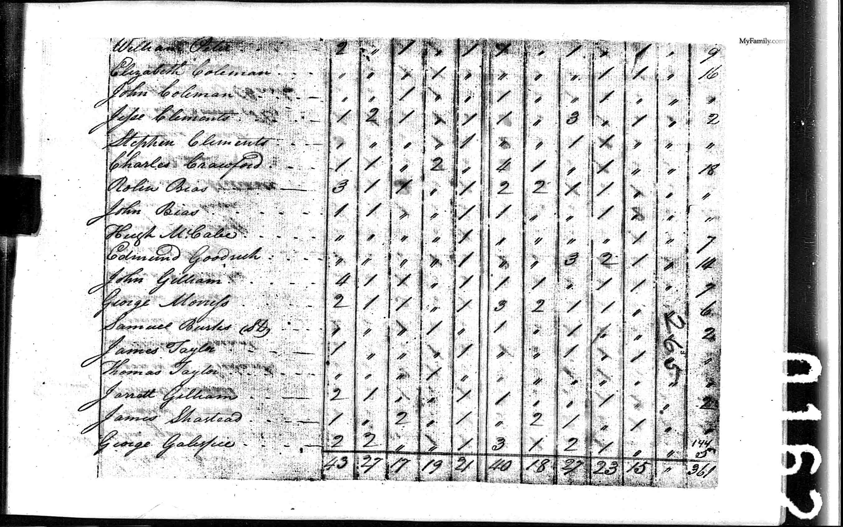
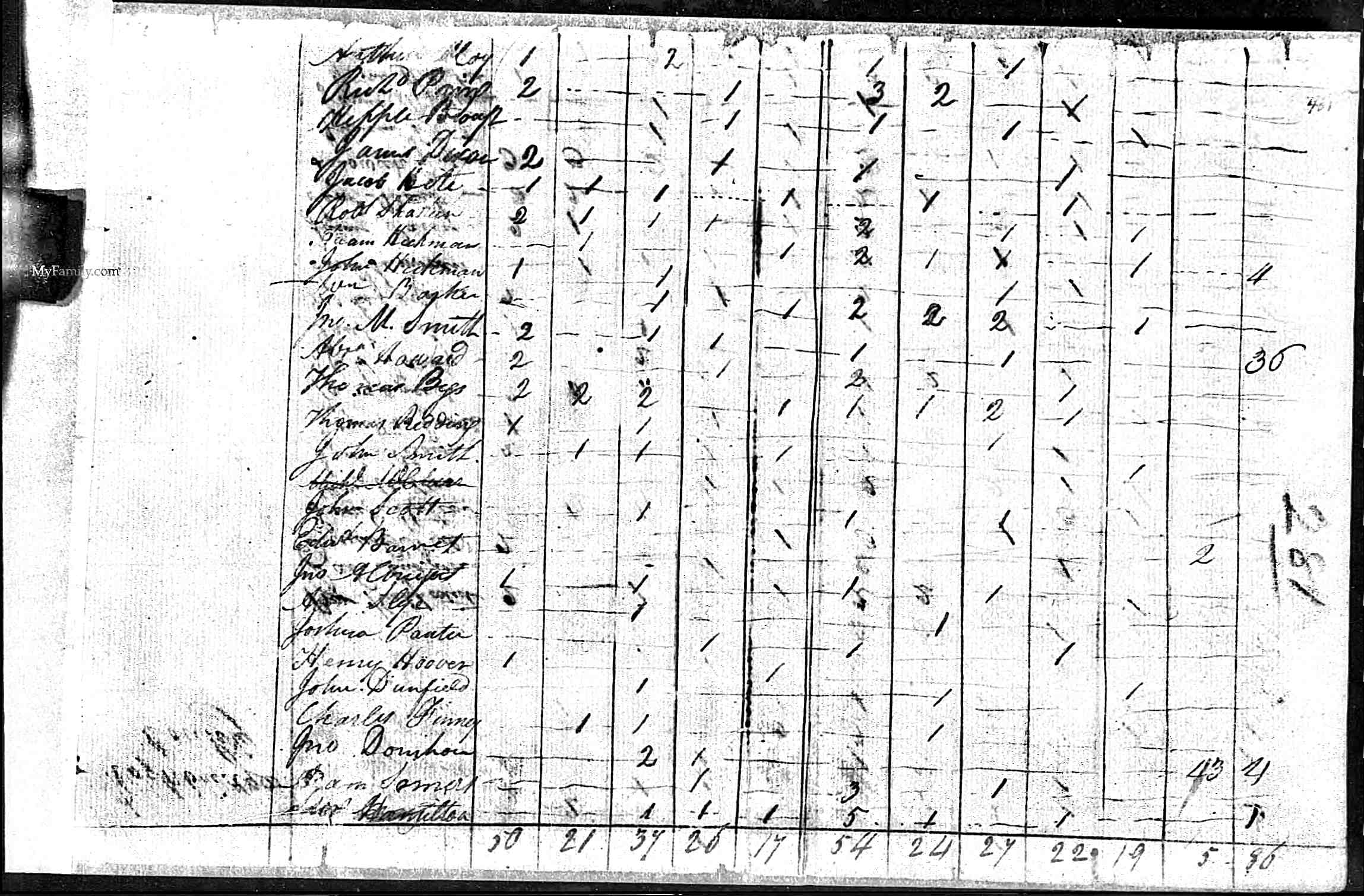
Miscellaneous Maps, Census Pages, Tax Roll Pages for this Research
|
|
Other Old Virginia Maps for this Research
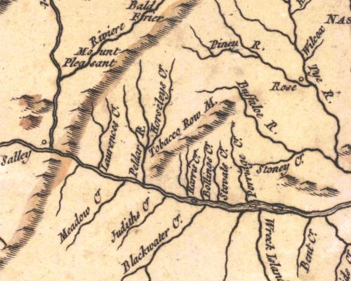
This 1755 map probably best shows the geographic
significance of "Pedlar" (Pedlar River, Pedlar Mills city) "Buff" (Buffalo
River) and "J River" used on the personal property tax rolls. |
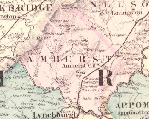
This 1877 map shows an updated version of the same geographic
references, plus includes Otter Creek. Note the pink shading for Amherst, - the
western border with Rockbridge essentially follows the crest of the Blue Ridge
Mountain Range. |
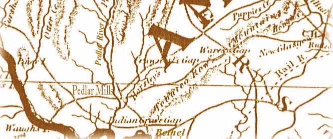 Map
of Amherst County, mid-19th century. From the Court House on the right of the
map a road leads southwest, crossing Tobacco Row Mountain
at Ware's Gap, proceeding through Crawford's Gap, crossing Horsleys Creek and
Pedlar River at Pedlar Mills. The road then intersects with the Indian Grave
Gap road, and ends at Waugh's Ferry on the James River. Waugh's Ferry was
used frequently as a crossing point on the James River for early migrations to
the southwest. Map
of Amherst County, mid-19th century. From the Court House on the right of the
map a road leads southwest, crossing Tobacco Row Mountain
at Ware's Gap, proceeding through Crawford's Gap, crossing Horsleys Creek and
Pedlar River at Pedlar Mills. The road then intersects with the Indian Grave
Gap road, and ends at Waugh's Ferry on the James River. Waugh's Ferry was
used frequently as a crossing point on the James River for early migrations to
the southwest.A ride from Amherst thru the Tobacco Row Mountains to Pedlar Mills and on to Otter Creek at the James River was a reasonable ride. Note this map is circa 1850. It appears to be about 12 mi from Amherst to Pedlar Mills and 6 mi more to Otter Creek at the James River. (Crow flies, not land path). |
|
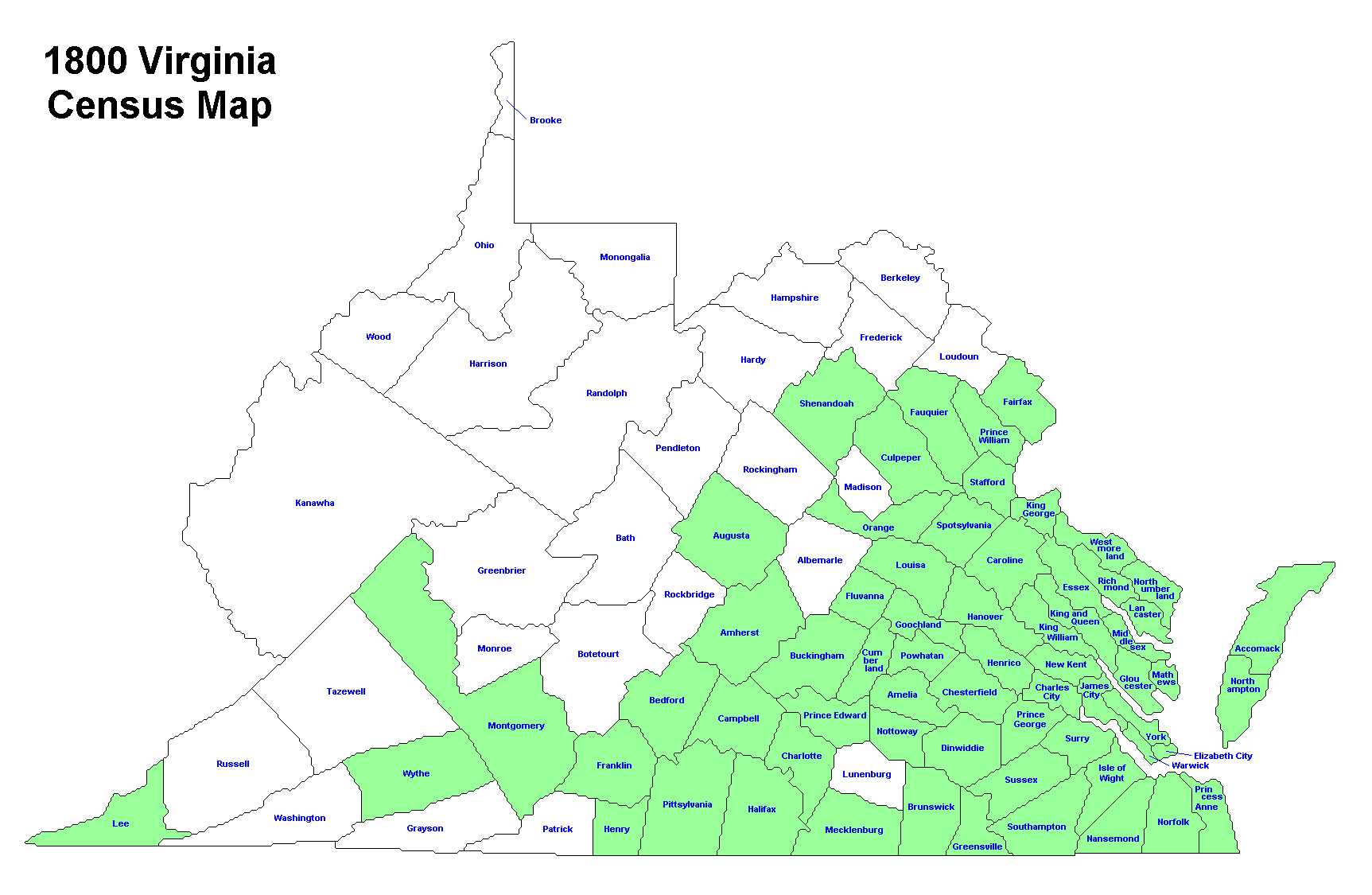
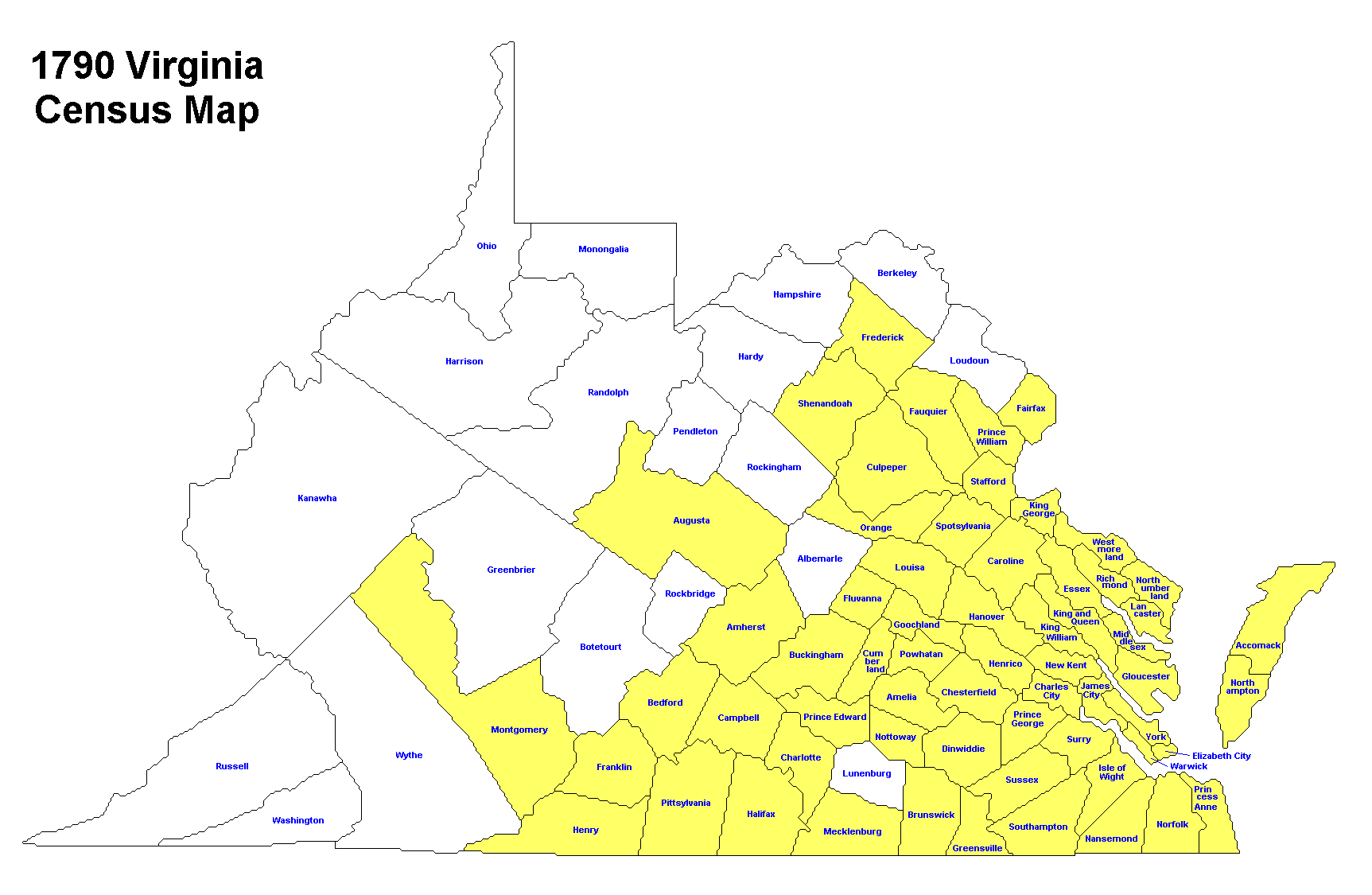
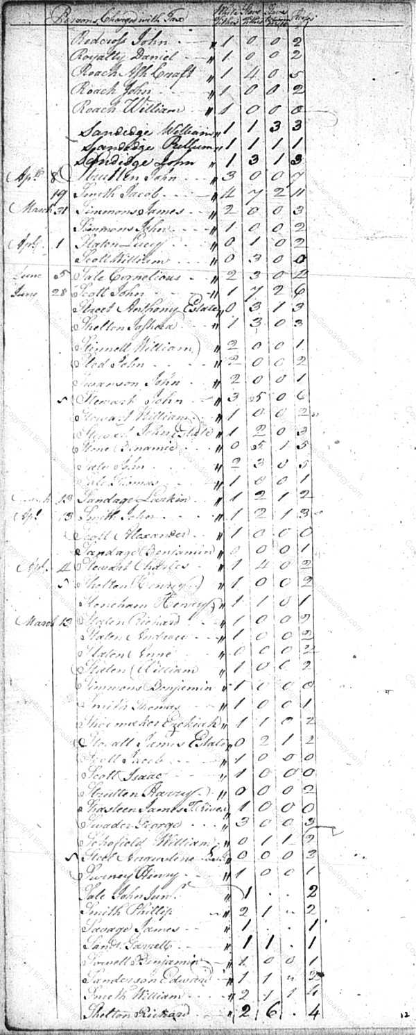
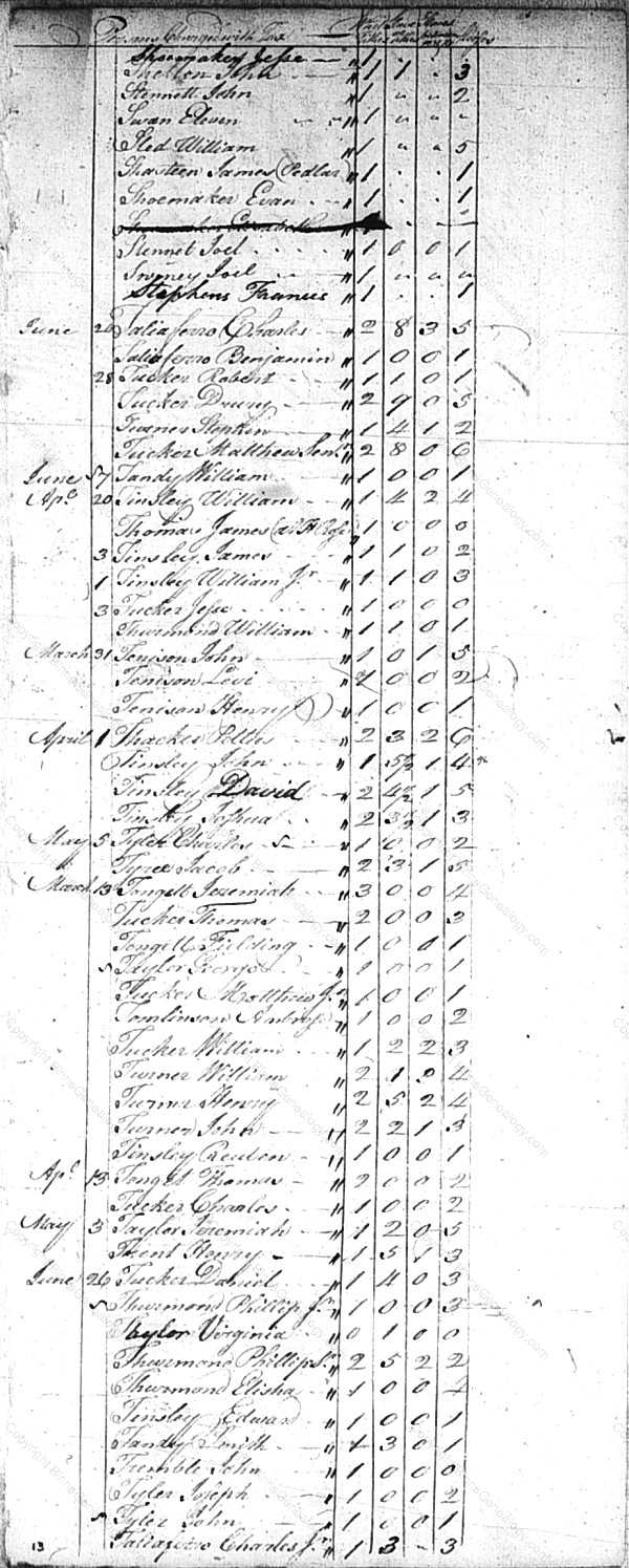
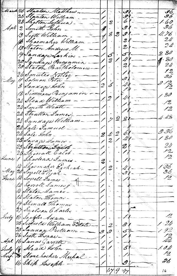
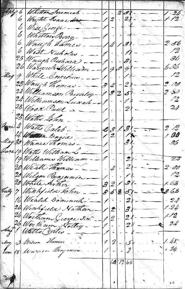
Miscellaneous
Amherst Co., Virginia - Tax List for Lexington Parish/District - 1800 - Column One – White males over the age of twenty-one - Column Two – Horses owned - Column Three – Slaves over the age of sixteen - Column Four – Slaves between the age of twelve and sixteen - Shastead, James 2-1-0-0 - Source http://www.rootsweb.ancestry.com/~vaamhers/tax/Amherst_tax_1800.html NOW A DEAD LINK, unable to re find, maybe in error? |
From the Alexander Brown papers in the
Special Collections Department, Swem Library,
College of William and Mary, Williamsburg, VA - The List contains the following
numbers: (This is the way Brown wrote his key) - 1. Of those who had
interests in Old Albemarle prior to 1761, nearly 2000 and is nearly complete a.
a. - This document is a key that Alexander
Brown made to some sources that he was using in the late 19th century. The
current location of many of these sources is unknown. Some of the records were
public, some may have been documents that he owned or to which he had access at
that time.
|
|
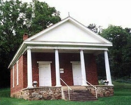
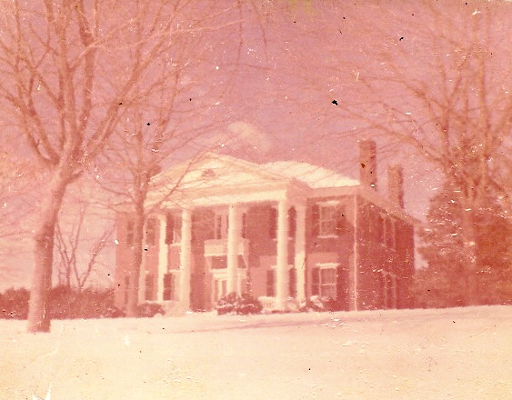 Red Hill, Amherst County, Virginia - Built on the Ellis plantation, this home was completed in 1825. This photograph shows "Red Hill" as it appeared in the winter of 1959-1960. It is on both the Virginia Historic Landmarks Register and the National Register of Historic Places. — Courtesy Amherst County Museum & Historical Society Discussion found on web: Edgar Allen Poe was an unofficial adoptee of Richmond businessman Allen, who was also a partner of the Ellis brothers of Pedlar Mills, Amherst County. Poe appears to have been raised (at least initially) with many of the privileges of these families. The Ellis family estate in Amherst was not small by any means, and Poe did spend summers and vacations there periodically, visiting the Red Hill plantation (Amherst County, not the other Red Hill associated with Patrick Henry...) - Holly Mills Amherst, VA HolladayMills@AOL.COM MAY NO LONGER BE GOOD There may be value in learning more about the Ellis family, but mostly I included this as it was interesting. |
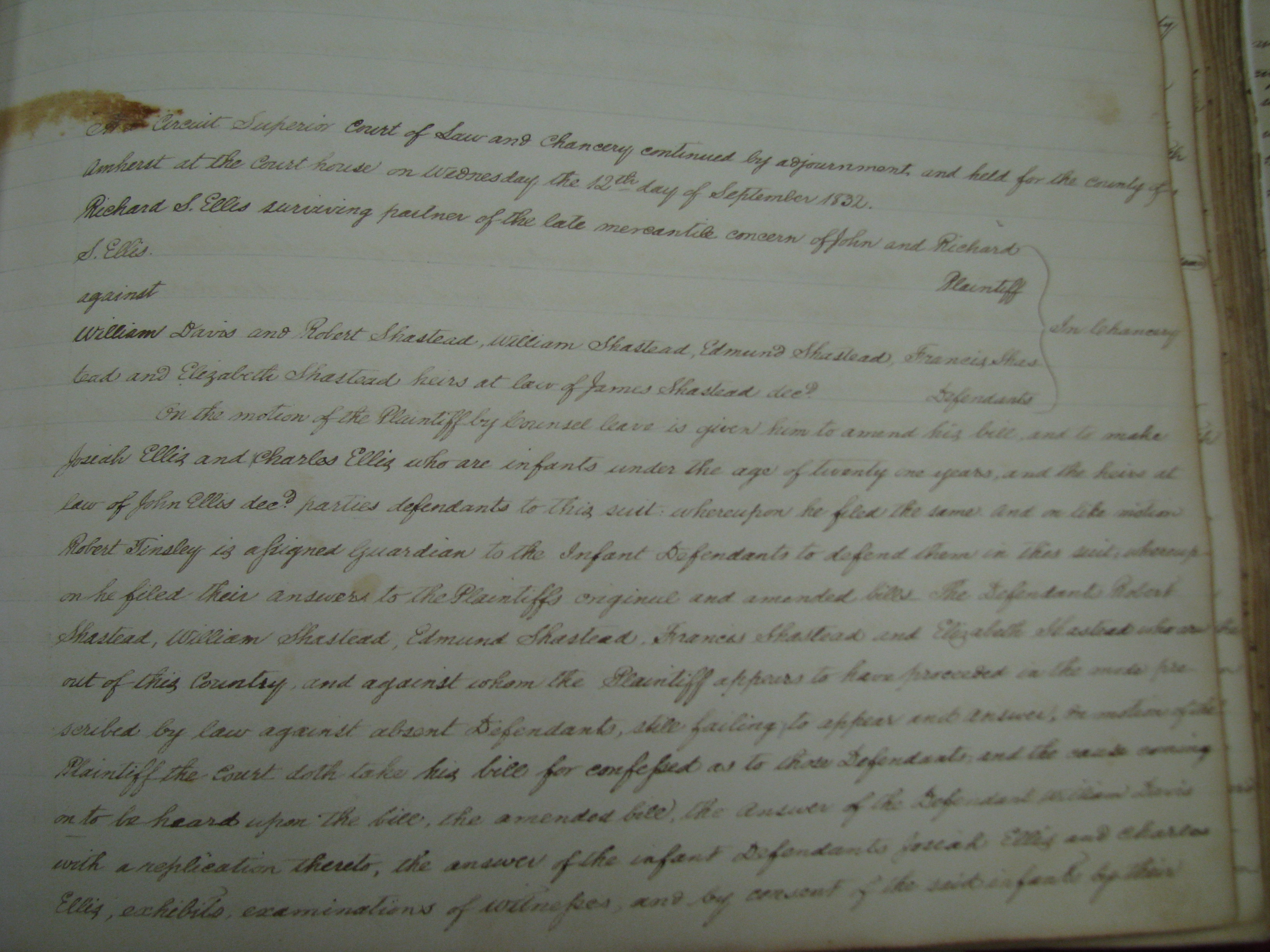
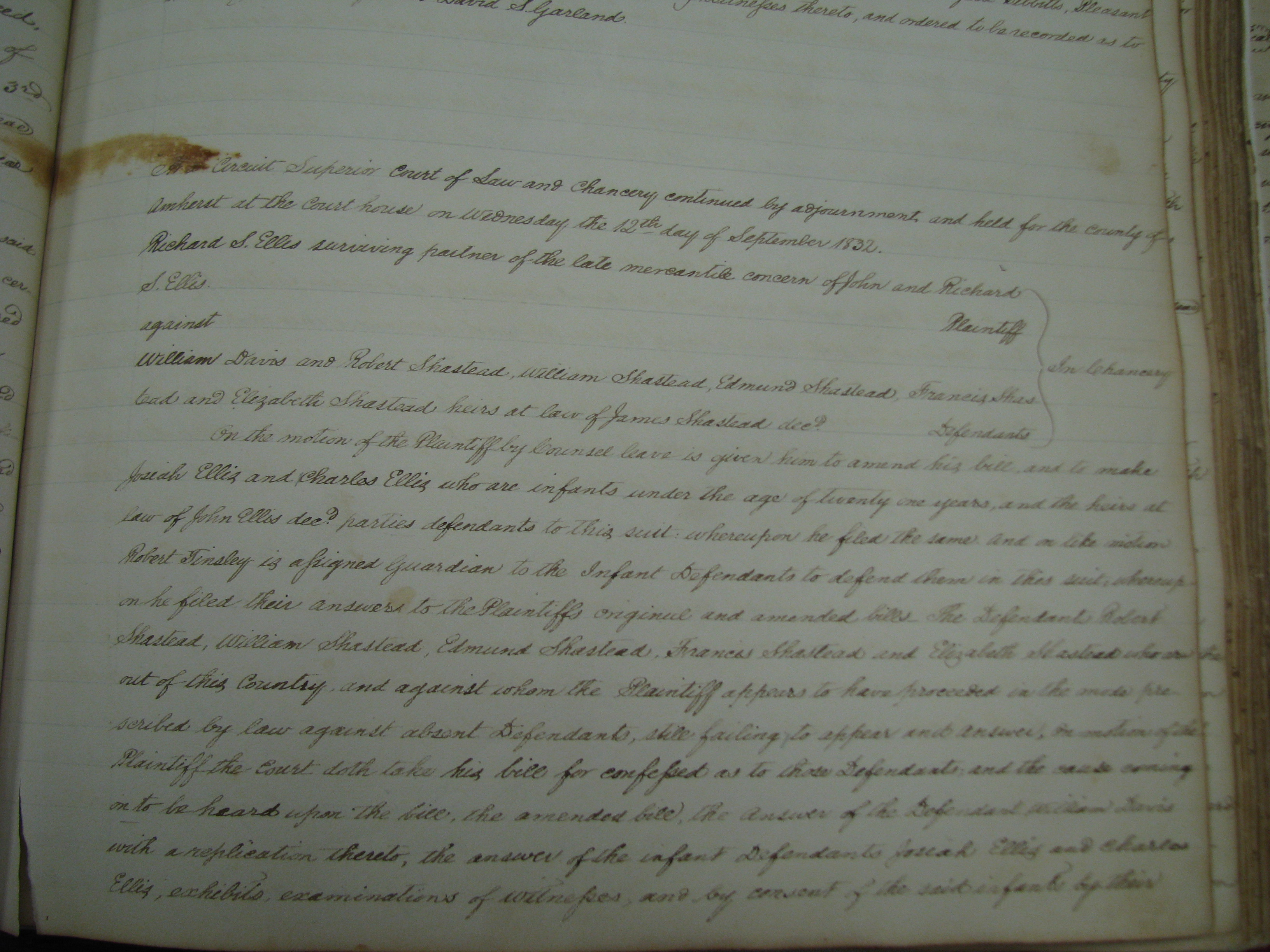
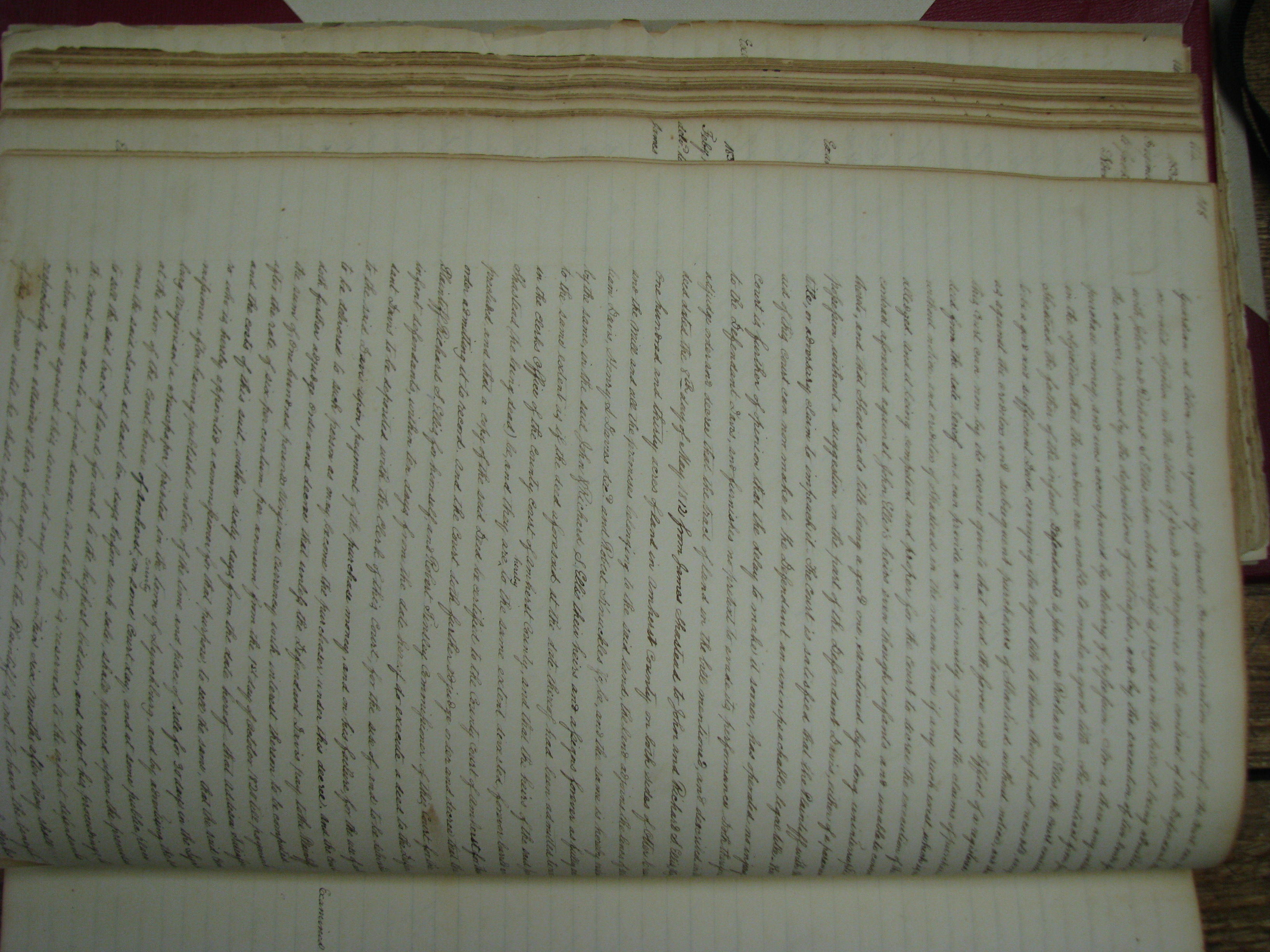
| Please advise of any other suggestions or information you might have regarding the paternity of the paternity of James Shasteen (Shastead / Chastain) (b circa 1755-60 ) as it keeps me up nights and I suspect the answer will wind up being unknowable and/or unprovable. |
![]()
Copyright © 1995-2014, All rights reserved